
 Approximate driving time with sightseeing
 Highest point
 Lowest point
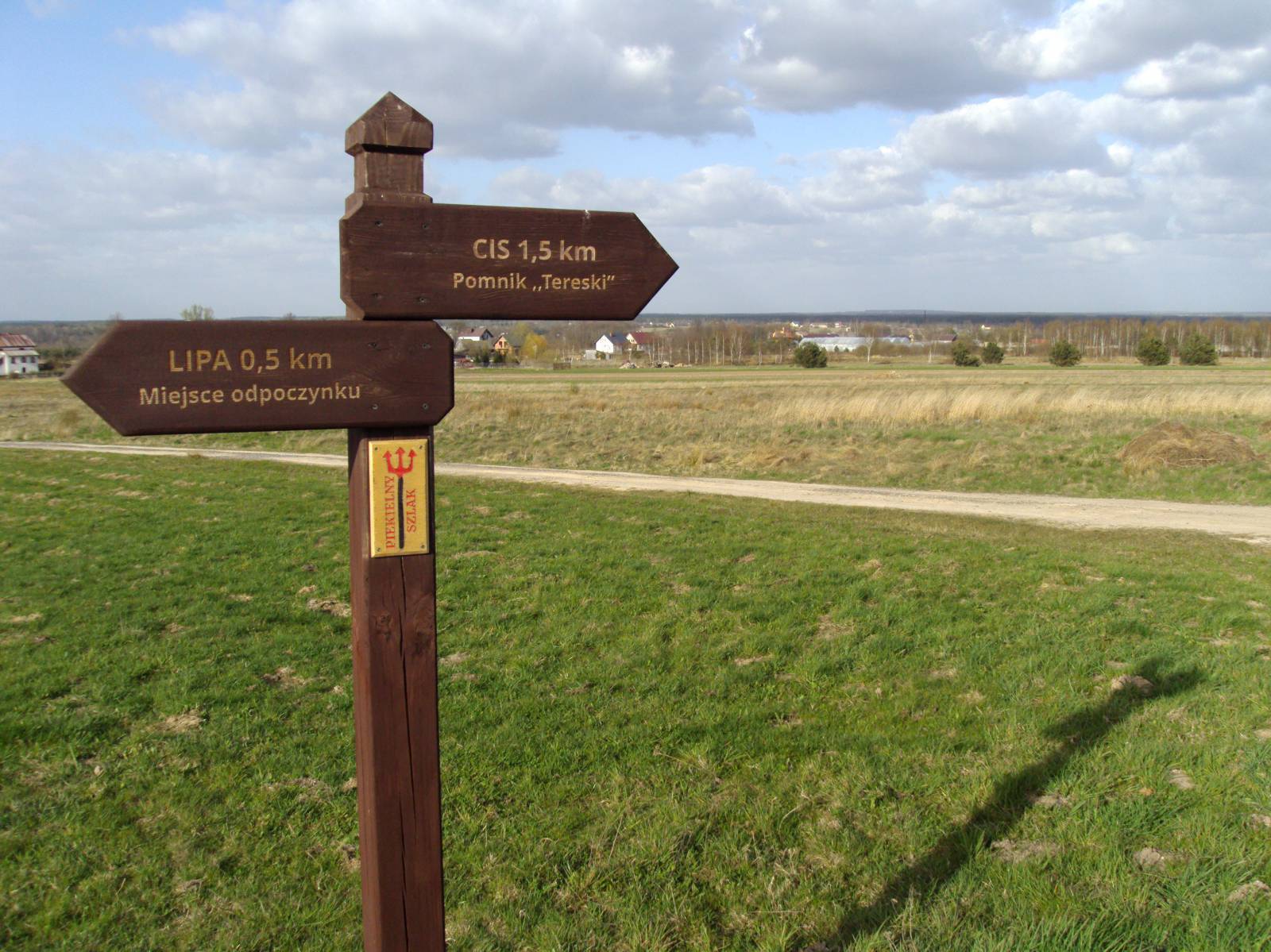
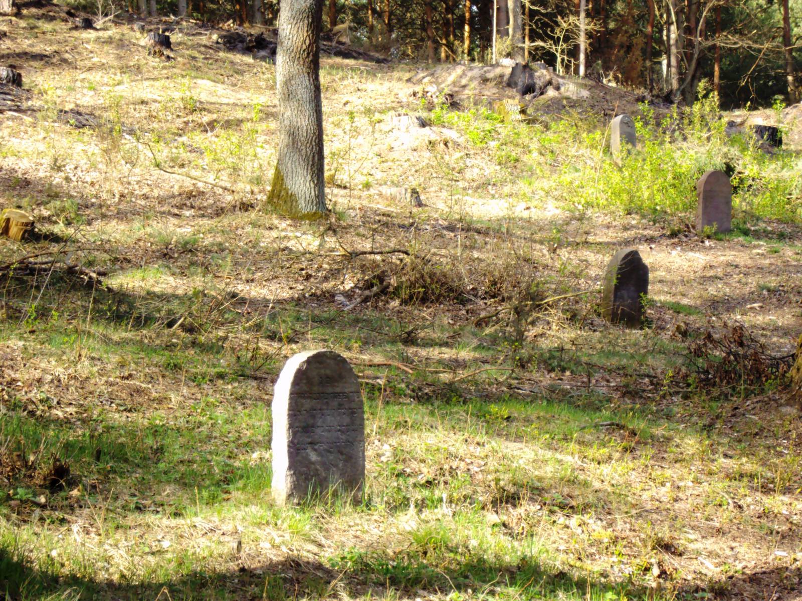
The trip that recalls the excellence of Radoszyce – a town cared about by the greatest kings of Poland. We encourage you to stop by here as Władysław Jagiełło and Casimir IV Jagiellon once did. Enter the mysterious climate of Radoszyce forests, where the last forces of insurgents defended the independence of Poland during the Kościuszko Uprising and the echoes of fights of Hubal’s guerrillas can be heard even now. Learn about the history of Jews and visit a unique site connected with their history – a Jewish cemetery with the ohel of Radoszyce tzadiks. You will begin your adventure on the market square in Radoszyce. You can have a look at the Church of St. Peter and St. Paul, the history of which dates back to the 14th century. The temple was rebuilt many times, and its final shape was designed in the 19th century. Ride through ul. Kościelna and then through ul. Kościuszki, Piotrkowska and Leśna, which will lead you out of the town towards the forest. At 2.7 km, turn left past the marks to the Jewish cemetery. After only one kilometre, you will see the cemetery (kirkut) that was founded before 1789 and enlarged at the beginning of the 20th century. Only the fragments of a few broken tombstones have survived till today, because the cemetery was devastated during World War II. In the 1980s, it was tidied up and the ohel of Radoszyce tzadiks was reconstructed. After visiting the cemetery, continue on a 3.5 km long trail along the forest down to the asphalt road. There are 2.7 km of the trail to Lipa in front of you. From October 1939 on, the village and the surrounding areas served as a place of accommodation of the famous division of Major Hubal, who started creating the first conspiracy structures here. Take a look at the wooden Church of St. Laurence and St. Catherine and at the primary school built in 1936. From the beginning, the school was managed by Józef Wyrwa alias Stary – the organiser of the underground troops and the commander of a guerrilla division within the National Health Service and the Home Army. Turn right beside the church; riding among farms and surrounding farmlands, you will reach Cis. If you go straight for 1 km, you will see the monument to “Tereska” – the only female guerrilla in Hubal’s divisions. When in Cis, head for Młotkowice and turn right past the red marks of the Hell’s Trail. Ride to Cieklińsk and cross the bridge on the Czarna river. You are in the Ruda Maleniecka Commune, which was known for the development of industry in the Old Polish times. The water reservoirs by which you are passing supported the functioning of many industrial plants. At the last stage of the trip, you ride down to the road no. 74, from which you must head for Kielce and then go right towards Jacentów and straight to Radoszyce.
Course of the trail:
- Radoszyce – 0 km
- Jewish Cemetery – 3 km
- Lipa – 10 km
- Młotkowice – 13 km
- Cieklińsko – 5 km
- Jacentów – 5 km
- Radoszyce – 4 km
Marking and infrastructure:
Marking:
- In the Cis – Młotkowice – Cieklińsko – the road no. 74 section, the marking of the Hell’s Trail is visible (the red hiking trail with direction stags) on a length of around 9 km.
- On the trail from the road no. 74 to Radoszyce: yellow marking on a section of 7 km.
- Marking of the Nordic Walking trail: red marks in the Lipa – Młotkowice section and black marks in the Młotkowice – Cieklińsko section (the board with a network of trails is located on the pond near the building of the Volunteer Fire Brigade in Młotkowice).
Infrastructure:
- Parking areas: at the Church of Peter and Paul in Radoszyce, beside the Jewish cemetery in Radoszyce, near the parish church in Lipa.
- The resting place in Lipa.
- The bench near the monument to “Tereska” in Cis.
Surface:
- 62% – the asphalt road, 38% – the unsurfaced road.
- The trail runs on roads with the low intensity of car traffic, mainly in the forested area with small shrines and national remembrance sites.
- From the cemetery, there are height differences on a length of around 5 km – the land level drops significantly past Lipa.
List of attractions on the trail:
To learn more about historic sites, contact the Tourist Information Centre in Końskie, ul. Partyzantów, 1, 26-200 Końskie, phone 41 372 90 88, e-mail: informacja@konskie.travel, www.konskie.travel.
- Radoszyce – the Church of Peter and Paul the Apostles;
- Radoszyce – Jewish cemetery;
- Church of Lawrence and Catherine and Lipa;
- Monument to “Tereska”;
- Water reservoir in Cieklińsk