
 Approximate driving time with sightseeing
 Connected with GreenVelo
Spanning just over 40 km, this recreational route takes the form of a loop around the town of Końskie. It goes mostly along asphalt and gravel roads that have good surfaces and low to medium traffic. The first part of the route goes through an unforested area and you will see a number of interesting architectural and technical monuments as you pass through the various villages. The second part of the route leads through the vast pine complex of the Końskie Forests. You will be able to take a break and relax beside one of the three reservoirs found along the way, and there are no significant ascents or descents.
Sielpia Wielka (0.0 km) → Nowy Dziebałtów (3.0 km) → Stare Brody (5.7 km) → Stary Kazanów (6.9 km) → Nowy Kazanów (8.3 km) → Sierosławice (9.9 km) → Modliszewice (11.1 km) → Proćwin (13.6 km) → Kornica (14.8 km) → Barycz (16.7 km) → Młynek Nieświński (19.1 km) → Drutarnia (21.0 km) → Stara Kuźnica (23.2 km) → Piła (28.5 km) → Piekło (37.1 km) → Sielpia Wielka (42.4 km)
- Lenght: 42.4 km
- Time: 4 hours (6-7 hours with sightseeing)
- Type: Touring, cross
- Elevation: 267 m
- 60% asphalt roads, 32% gravel roads, 6% unpaved roads, 2% bike paths
- Moderately difficult
- Marking good; red bike trail
Getting there and starting out
The trail begins in Sielpia Wielka, the largest summer resort in the Świętokrzyskie region. You can leave your car in the car park at the southern shore of the reservoir. In order to get to the red bike trail, take the bike path on the bridge over the Czarna River. As you ride over this very impressive-looking bridge, you will see the buildings of the former rolling mill and puddling plant.
Technical description
When you reach the intersection, there are signs for the red bike trail, as well as an MOR (Miejsce Obsługi Rowerzystów – Cyclist Service Point) on the Green Velo trail. The first part of the route goes along asphalt roads through Nowy Dziebałtów, Stary Dziebałtów, Brody Stare, Stary Kazanów and Nowy Kazanów, where you will pass the remains of the Kazanowski manor house. At the junction with national road no. 42, a mighty oak tree will come into view, and the nearby Bernardine Monastery is well worth a visit if you have the time. Past Nowy Kazanów, a limited panoramic view of the Opoczyńskie Hills will open up on the left. The route then goes through Sierosławice to Modliszewice (voivodeship road no. 746), a village with a defensive manor house about 400 m off the route to the right. After that, head for Proćwin, which you will reach after a fast downhill section on a gravel road. The next stretch to Kornica has a short section with a cycle path, where you will see the new Końskie investment zone on the right. In Kornica, cross the railway tracks connecting Końskie to Opoczno and Skarżysko-Kamienna, which are currently used for freight transport only. Continue on to Barycz, where you can take a break in a shelter by the pond. Cross the voivodeship road, and then you will pass another pond with a small beach. The forest section to Młynek Nieswiński goes along a dirt path. This village on the Młynkowska River is where the buildings of an old forge have survived, which were later turned into a mill for grinding clay used in dyeing. Then there is a pleasant asphalt section that goes through Drutarnia, where there is also a rest area by a pond, before you reach Stara Kuźnica and its historic water forge situated on a picturesque pond. There is another rest area with a shelter and a beach 400 m from the trail. As you leave behind the village houses and go into the forest, you’ll come to the gentle slopes of the Koneckie Hills. When you get to the village of Piła and national road no. 42, take a moment to look at the Tarnowski Manor House from the end of the 19th century and the six old oak trees close to the pond. For the next 1.5 km, stay on the national road. After a right turn, there is a straight stretch through the forest, where the route coincides with the red hiking trail called Piekielny Szlak (Infernal Trail). Past the intersection of the Końskie to Wąsosz road, the route continues along a narrow strip of asphalt road where no motor vehicles are allowed. Along the way, you’ll pass a peat bog, before the asphalt road ends in a clearing past the small village of Piekło (meaning “Hell” in Polish, hence the name of the hiking trail). Take a 600 m detour to the right, and you will come to the “Skałki Piekło-Gatniki” (Hell’s Rocks) natural monument. These are stunning sandstone outcrops that have been smoothed out over time by the effects of wind erosion. The route ends back in Sielpia Wielka, which completes the loop around Końskie.
Attractions along the way:
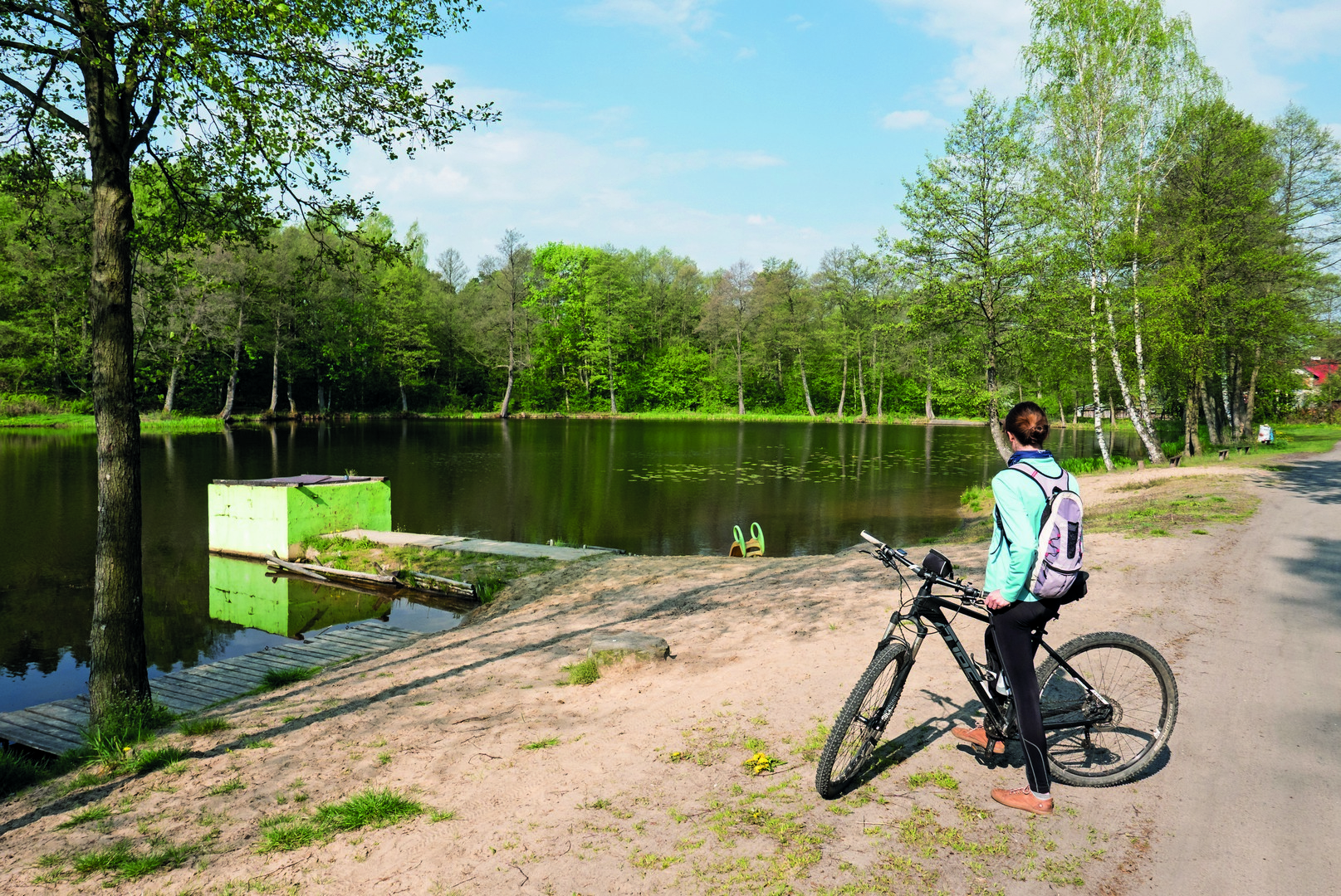
Reservoir in Sielpia Wielka
This artificial lake on the Czarna River, which was created in 1960, currently serves a recreational purpose. There are numerous guest houses located on the banks of the reservoir which, in combination with the rich food and entertainment options available, have helped to make Sielpia Wielka a popular holiday resort. As a result of the 2021 modernisation of the infrastructure around the reservoir, a new pier has been added, as well as a road connecting the north and south banks.
Museum of the Old-Polish Industrial Region in Sielpia Wielka
This unique technical monument is situated in a former complex of rolling mills and a puddling plant which was created on the Czarna River as part of the Old-Polish Industrial Region in the years 1821-1842. The plant remained in operation until 1921. There is an exhibition of the old machines that were in use back then in the halls of the complex, including the largest working water wheel in Poland, with a 9 m diameter.
- Słoneczna 19 (temporarily closed)
Remains of a manor house in Nowy Kazanów
The Kazanowski residence was probably erected around the middle of the 16th century and it served a defensive purpose. The only elements still surviving are the mound covering the foundations and the remains of the moat, though there are information boards giving more details about the history of the place.
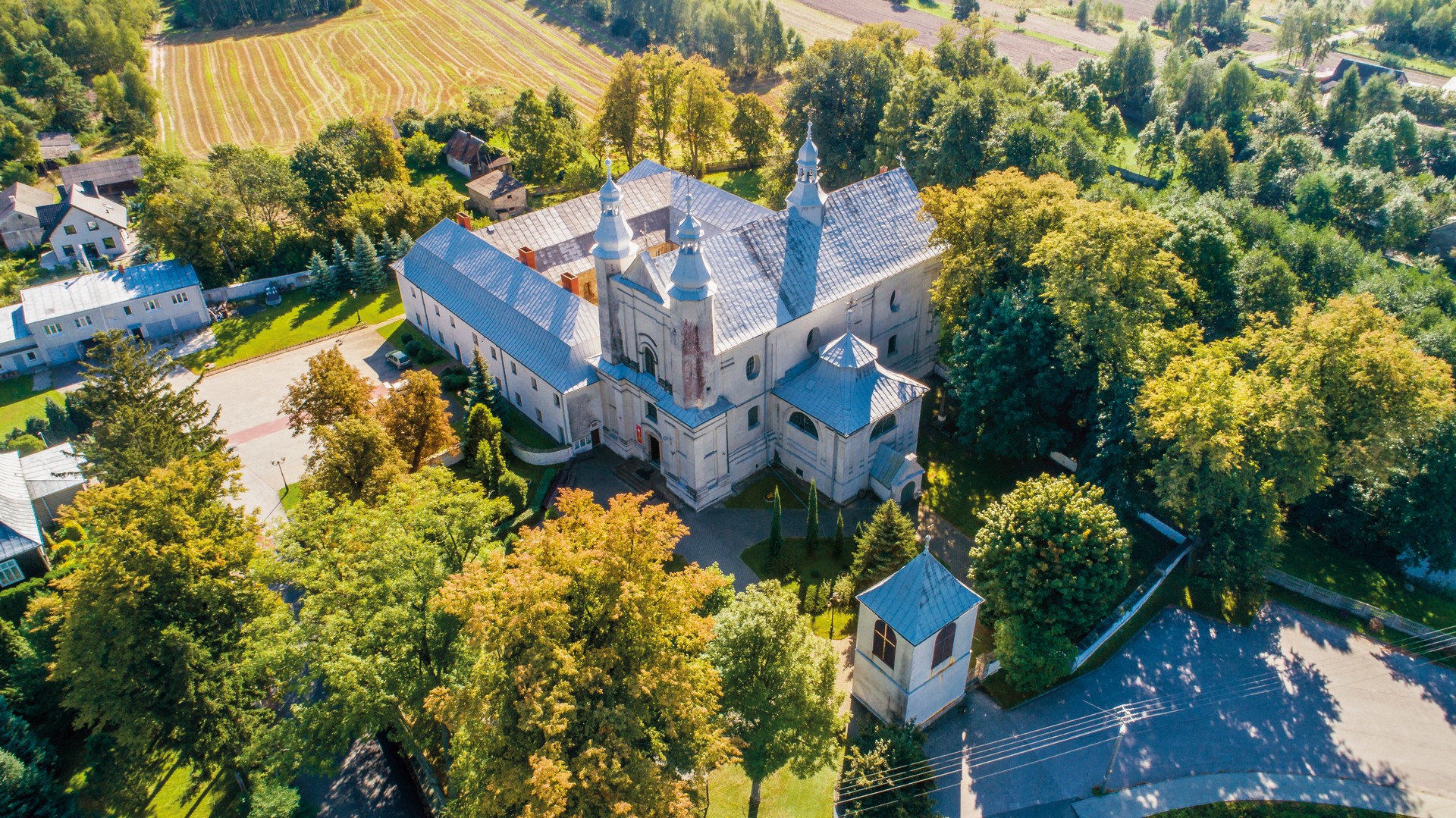
Bernardine monastery complex in Nowy Kazanów
This historic complex consists of a church and monastery from the second half of the 17th century. The church has rich Baroque and Rococo interiors that you can admire, while down in the cellars are the stone sarcophagi of the Kazanowski family – the former owners of the village. The monastery complex is surrounded by a wall and numerous trees, which are also classed as natural monuments.
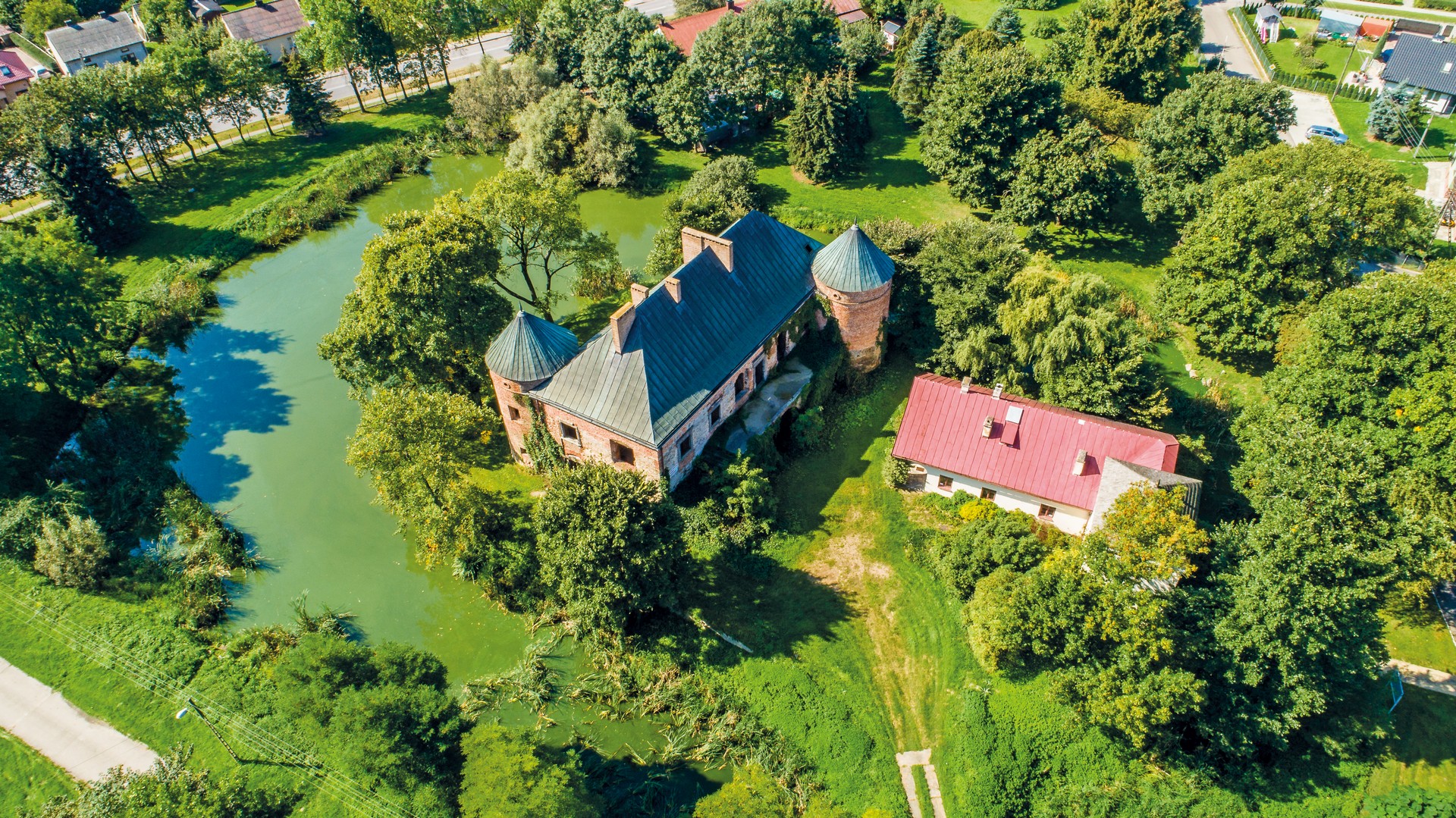
Defensive manor house in Modliszewice
This partly ruined Renaissance defensive manor house from the 16th century is situated in a picturesque spot on an artificial island. Believed to have been designed by the famous Italian architect, Santi Gucci, the building is currently owned by the Świętokrzyskie Agricultural Advisory Centre and access is possible during the working hours of the centre.
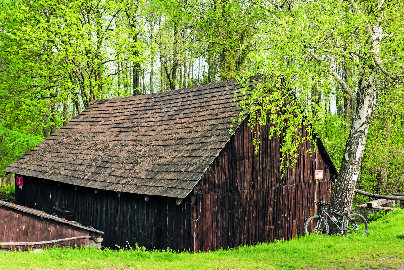
Water forge in Stara Kuźnica
This is the only water forge in Poland to have survived in its original form, and has a water system typical for the 18th century. The historic machines are on display in a wooden building from the 19th century. Next to the forge is an artificial lake that can be used for recreational purposes (temporarily closed).