
 Highest point
 Lowest point
 Sum of driveways
 Sum of downhill
 Slope
Slope Marking
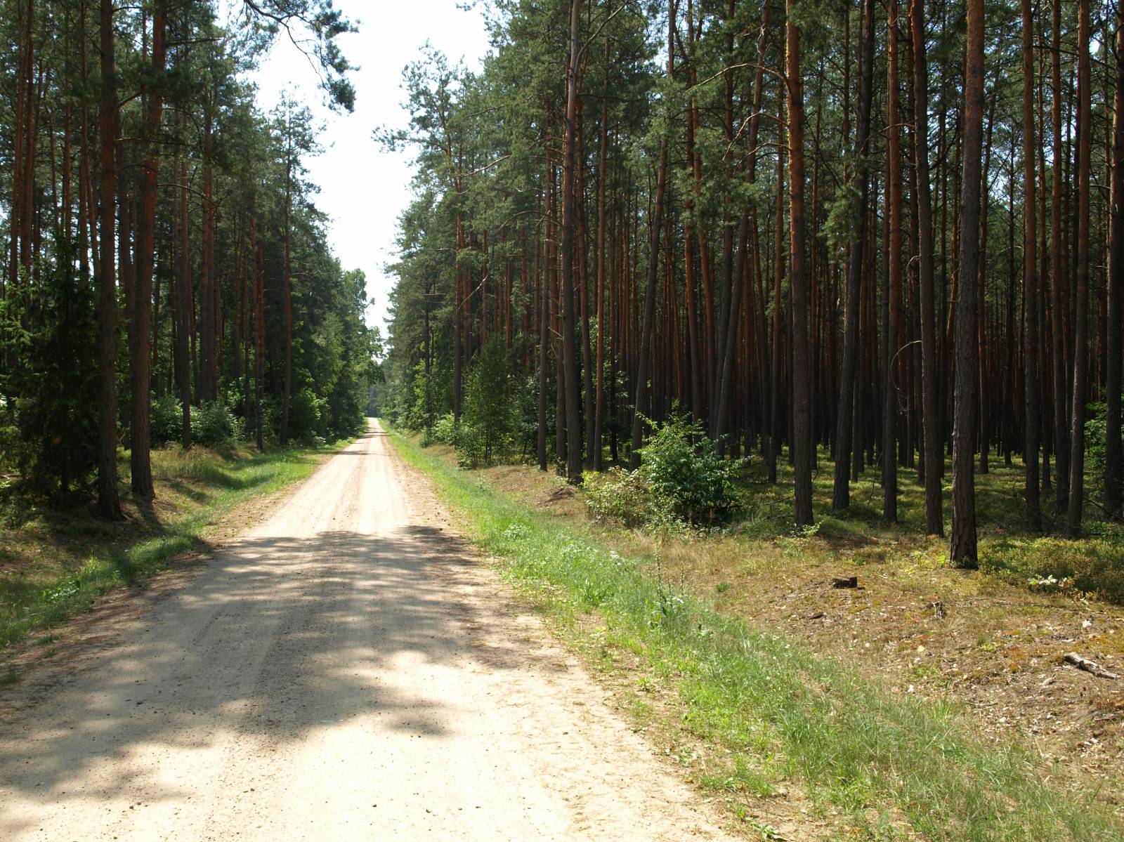
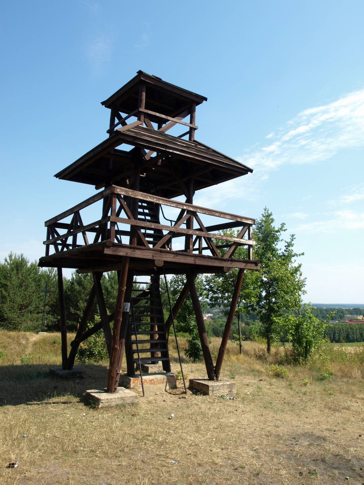
Marked in red, this trail takes forest firebreaks in the vast complex of Sobibór Forests, which are protected as a landscape park. It is 36 kilometres long and goes from Włodawa via Okuninka and Sobibór to Wola Uhruska on the Bug. The area the trail crosses consists mostly of sandy, pine-covered plains. The trail is difficult, especially in view of the sandy stretches which are very hard to get through on a bike. Taking a good map or a GPS trace is recommended due to the shortcomings in the marking of the trail. The standard of marking is reminiscent of PTTK (Polish Tourism and Sightseeing Society) signs, with metal plates and painted blazes. Unfortunately, they are quite old and scarce. Paved roads make up only less than 10 km of the total route, and they tend to be little frequented local roads. Almost the entire route goes on flat terrain. The only elevation point is the edge of the bug River Valley near Wola Uhruska, which has a lookout tower on top.
The general route of the trail is as follows: Włodawa, town centre (0.0 km) - Okuninka, swimming beach (6.0 km) - “Żółwiowe Błota” reserve (15.1 km) - Sobibór, Museum (17.2 km) - “Jezioro Brudzieniec” reserve (22.0 km) - “Trzy Jeziora” reserve (24.0 km) - Stulno forester’s lodge (26.8 km) - Majdan Stuleński (31.7 km) - Wola Uhruska, lookout tower (35.4 km) - Wola Uhruska (36.1 km).
The area through which it goes is the trail’s main advantage. It begins in Włodawa, a town on the Bug. Full of monuments, it is referred to as the City of Many Cultures. The start of the trail in this city and the end in Wola Uhruska are at the same time points of contact with a Green Velo trail. The two trails crisscross twice more between these localities. However, due to the sandy surface, this trail should not constitute an alternative to travelling along the Green Velo trail. The area was an arena of partisan fighting in the time of the 1863 January Uprising, during World War II and in the post-war years. Until 1945, most of the village inhabitants were Ukrainians. After the war, they were resettled to the so called “Recovered territories”, and part of them emigrated to the USSR. Richly carved, wooden houses, preserved in villages and hamlets scattered in the woods, are a reminder of these former inhabitants. A modern tourist attraction in the area as well as a great place to take a rest stop on the trail is located near Włodawa, in the locality of Okuninka. The town lies on Lake Białe with crystal clear transparent water. Extremely popular during the holiday season, the place gets visited by crowds of locals from the Lublin region. It has a beach, a swimming area and a water sports centre. Okuninka is also a prime location in terms of accommodation and food options. A cyclist equipped with a good map will certainly be interested in visiting a few appealing places situated in the vicinity of the trail. Unfortunately, they are not marked with signs. The most interesting are two nature reserves: Żółwiowe Błota and Trzy Jeziora (meaning “Turtle Muds” and “Three lakes”, respectively). They protect lakes and peat bogs hidden amid woods and populated by numerous and rare plant and animal species, including European turtles. Meeting this rare reptile requires plenty of luck. Out of the two, especially the “Three Lakes” reserve is well arranged for visitors. There are walking paths through the bog and a lookout tower. Together, they are part of the “Stulno” educational path. The Sobibór Forests, today mostly known for their unspoiled nature, witnessed one of the darkest times in European history. In the shade of the pine trees, near the Sobibór-Stacja train station, is the site where the Nazis annihilated 170 000 Jews from Poland and many other German-occupied countries during World War II. Nowadays, the place serves as the Museum of the Former Concentration Camp in Sobibór. The bike trail goes past the section of the former camp that is open for visiting. You can see the Memorial Avenue, as well as sculptures and plaques commemorating those who perished in the Holocaust. The trail ends in the tourist resort of Wola Uhruska, picturesquely nestled in the Bug Valley. You can take in the panoramic view of the river from the wooden lookout tower situated near the trail.
Points of interest along the trail:
- Włodawa - monuments of this multicultural city
- Okuninka - tourist resort, beach and swimming area on Lake Białe, water sports
- “Żółwiowe Błota” nature reserve
- Sobibór Forests complex
- Museum of the Former Concentration Camp in Sobibór
- “Three Lakes” nature reserve and “Stulno” educational path
- Observation tower in Wola Uhruska
- Tourist resort Wola Uhruska on the Bug
Not all fragments of the trail are suitable for bicycles with panniers/bike trailers. The trail uses solely roads with no motor vehicle traffic allowed or local roads with a low and very low vehicle traffic; no dangerous intersections.
Starting point:
Włodawa, Kraszewskiego street
Finishing point:
Wola Uhruska, Parkowa street