
 Highest point
 Lowest point
 Sum of driveways
 Sum of downhill
 High slope sections
 Connected with GreenVelo
 Slope
Slope Marking
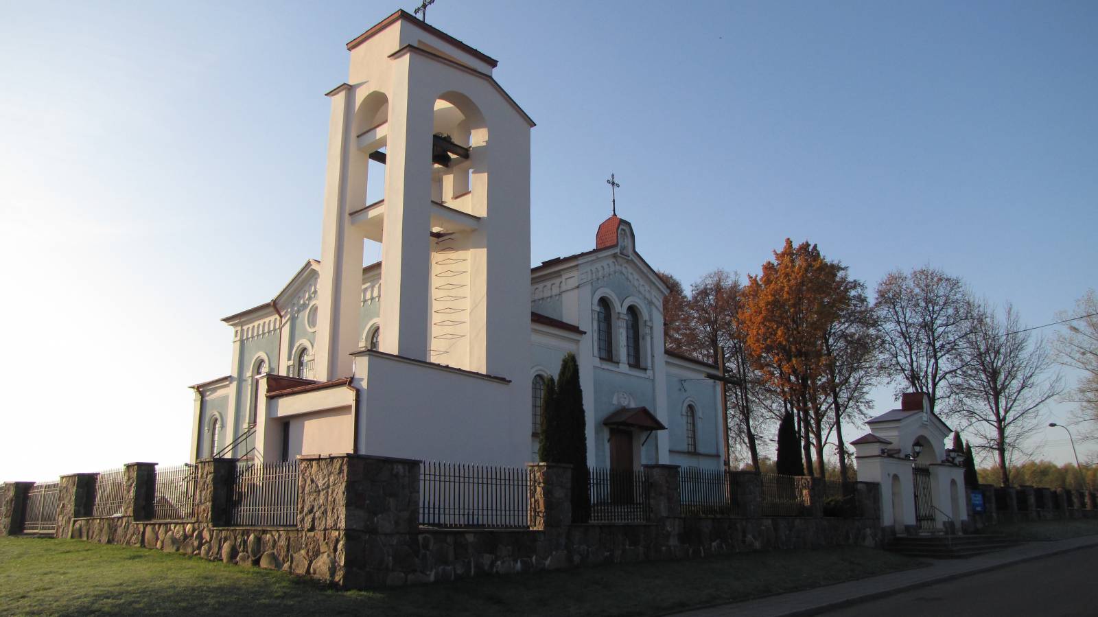
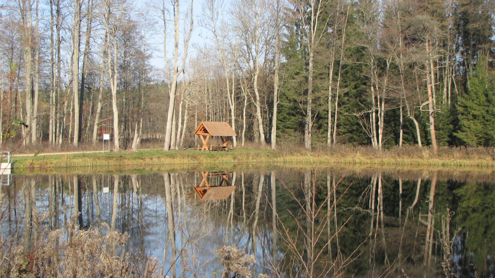
The green trail in the municipality of Michałowo is an interesting and rather long bike route, spanning 75 kilometres. Well-marked, the trail uses mainly dirt roads of quite good quality, as well as paved roads. It begins in Jałówka at the Belarusian border and goes via Michałowo to Królowy Most in the heart of the Knyszyn Forest (Puszcza Knyszyńska). The route is very varied, traversing both forests and farmland, through numerous villages with wooden architecture typical of Podlasie. Among the attractions of the trail, there are numerous Orthodox churches and shrines, as well as scenic views and the Siemianówka artificial lake.
The general course of the trail is as follows: Jałówka (0.0 km) - Nowosady (3.8 km) - Bachury (15.6 km) - Bondary (22.8 km) - Juszkowy Gród (27.2 km) - Gorbacze (36.8 km) - Nowa Wola (43.4 km) - Michałowo (47.8 km) - Hieronimowo (54.9 km) - Topolany (58.3 km) - Sokole (66.1 km) - (74.8 km).
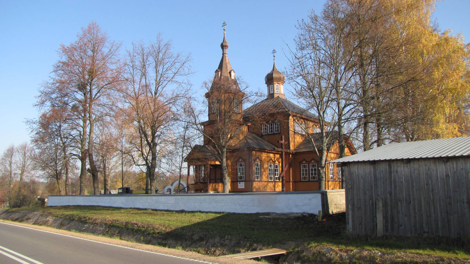
The route begins in the village of Jałówka, almost on the border with Belarus, in an area very distant from major roads. In the south, that area ends as it meets the Siemianówka lake, while in the north it is limited by vast forests. The largest locality, Gródek, is over a dozen kilometres away. Interestingly, Jałówka used to be a city for centuries. What remains after its heyday is the preserved spatial layout, typical for small towns, and numerous religious monuments – a Catholic church, an Orthodox church and chapel, and a Jewish cemetery. From Jałówka, the trail goes through vast fields and small villages in the direction of the Siemianówka lake. It is one of Poland’s largest artificial reservoirs, built in the years 1977-1990. Its total area is more than 32 sqm, and the average depth, depending on the level of the water, ranges from 1.5 to 3.5 metres. The trail follows its north shore, which is poorly developed, until the village of Bondary. There is an earth embankment in the vicinity, which dams the Valley of the Narew River and forms the lake. From here, the trail goes through the village Juszkowy Gród, which has a historic church, to the peat bog reserve on Gorbacz Lake. This is a highly interesting place, created to protect one of the last glacial lakes from the Riss ice age in this part of Poland, and its surrounding wetlands. The route continues west, to the village of Nowa Wola, where you can see another historic Orthodox church. You are now close to the small town of Michałowo, which is also the seat of the whole municipality. Just like many localities surrounding Białystok, under the Russian partition it used to be a large centre of textile industry, inhabited mainly by Germans and Jews. Michałowo was granted city rights in 2009, and apart from the already mentioned Orthodox church, you can also admire the well preserved 19th-century architectural layout of this industrial town. In the eastern part of the town, in the upper reaches of the Supraśl River, there is a small artificial lake. From Michałowo, the trail heads west to the village of Hieronimowo, where you must see the picturesque ruins of an 18th century palace. From Hieronimowo, the trail heads to the village of Topolany, which has an 18th century church dedicated to the Transfiguration. Past Topolany, the character of the trail changes dramatically. Open fields, characteristic of the area of Michałowo, are replaced by the woods of the Knyszyn Forest, which accompany the cyclist until the end of the trail in Królowy Most. These are mixed forests, with a large share of pine trees, protected as a landscape park. Apart from a small village and the Sokole railway station, the trail traverses this dense forest complex for 15 kilometres. It comes to an end in Królowy Most, where there is another historic Orthodox church. As far as returning to Jałówka, you can take the yellow bike trail via Gródek, which together will make for a weekend trip with a length of more than 140 kilometres. You can also take the green or blue trail to Białystok, which is about 20 kilometres away.
Points of interest along the trail:
- Jałówka - religious monuments, urban layout
- Siemianówka artificial lake
- Juszkowy Gród - Orthodox church
- “Jezioro Gorbacz” peat bog reserve
- Nowa Wola - Orthodox church
- Michałowo - religious monuments, urban layout
- Hieronimowo - palace ruins
- Topolany - Orthodox church
- Knyszyn Forest Landscape Park
- Królowy Most - Orthodox church
The entire trail is suitable for bicycles with panniers/bike trailers. The trail uses solely roads with no motor vehicle traffic allowed or local roads with a low and very low vehicle traffic; no dangerous intersections. Trail of outstanding natural beauty.
Starting point:
Jałówka - market square
Finishing point:
Królowy Most - intersection with national road no. 65