
 Highest point
 Lowest point
 Sum of driveways
 Sum of downhill
 High slope sections
 Slope
Slope Marking
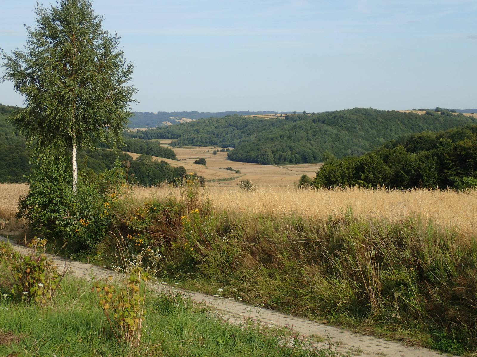
The Dymitr of Goraj Bike Trail is a route for people experienced in heavy off-road riding. It is slightly more than 40 km long and runs through the hills and ravines of the Szczebrzeszyn Landscape Park and its surroundings. This is one of the best signposted and managed tourist trails of the Roztocze Region.
The general course of the trail is as follows: Goraj (0.0 km) - Hosznia Abramowska (8.5 km) - Chłopków (15.6 km) – Doliny (19.6 km) - Świniarki (22.0 km) - Kawęczynek (29.4 km) - Lipowiec (40.4 km).
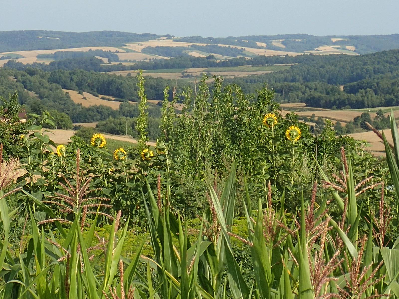
What makes the route different are the unique views and the diversity of landscapes of one of the most beautiful parts of the Lublin region. It is a difficult route and has numerous ascents and descents, stretches over field and forest roads, firebreaks and paths. Numerous ravines and river valleys intertwine along the route with extensive hill ridges, which offer a breath-taking panorama of the area. On the route, apart from a short fragment of national road no. 74, there are almost no asphalt roads and road traffic.
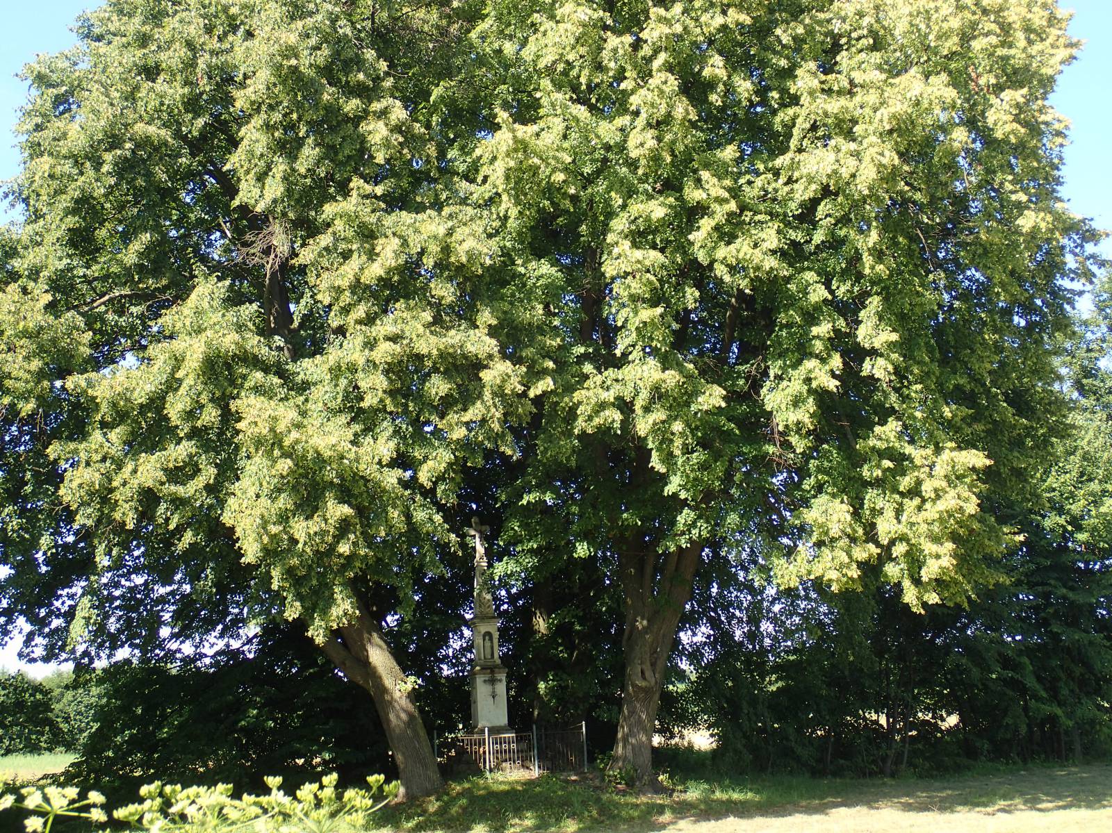
The trail offers quite a lot of variety due to numerous wooden huts, colourful, rural, roadside shrines, old crosses and monuments, as well as deep loess ravines and fast flowing creeks that cross the trail. Numerous well-presented information boards and resting points offer good rest on this demanding route. The trail is recommended only for people who are in good shape and use mountain bikes / MTBs.
The patron of the trail is Dymitr of Goraj, one of the greatest Polish magnates of the early Jagiellonian era and one of the most trusted collaborators of the Polish king Władysław II Jagiełło. For the merits for the homeland he received the title of Crown Treasurer and then Marshal as well as vast estates from the King in the area through which the route runs now. His family and descendants multiplied his property and faithfully served the homeland. The signposts on the trail bring you closer to the patron of the route and his achievements.
The trail starts in the locality of Goraj, in the eastern part of the village, at the intersection with the Central Cycling Route of Roztocze. From this place it runs east, towards the valley of Gorajec brook. Along the way, it crosses the vast range of picturesque hills, twice crossing the valley of brooks flowing down the hills to almost 100 meters. This means that in this short section the cyclist has to overcome several hundred meters of uphill and downhill slopes with a practically submontane nature. Fortunately, the route runs on quite good roads.
In the further part of the route, after crossing the Gorajec brook, the trail climbs the next range of hills, stretching westwards from Szczebrzeszyn and the Wieprz river valley. This part is a bit easier, because the trail runs mainly on the hill ridges, which offer exceptional views, accompanying cyclists to the very end of this unique trail, located in vicinity of the locality of Lipowiec near Zwierzyniec.
Points of interest along the trail:
- Landscape value of Szczebrzeszyn Landscape Park and surrounding areas - picturesque views
- Traditional rural construction - old, wooden cottages, quaint little shrines
The entire trail is suitable for bicycles with panniers/bike trailers. The trail uses solely roads with no motor vehicle traffic or local roads with a low and very low vehicle traffic; no dangerous intersections. A trail for lovers of mountain biking and off-road cycling. Trail with outstanding natural beauty. Trail offering outstanding vistas.
Starting point:
Goraj, the eastern edge of the village on the bend of the Central Cycling Route of the Roztocze Region
Finishing point:
Lipowiec, main crossroads (at the place which is next to the “Wzgórze Polak” trail)