
 Highest point
 Lowest point
 Sum of driveways
 Sum of downhill
 High slope sections
 Connected with GreenVelo
 Slope
Slope Marking
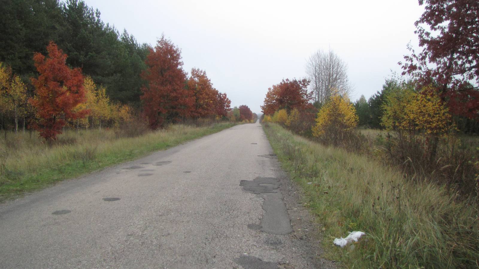
The almost 60 km long Czeremcha – Siemiatycze bike trail is marked in green. It goes through a number of interesting localities in the valley of the Bug River, most notably Mielnik. Along the way, you get to see pretty views, old churches and shrines, as well as numerous villages typical of Podlasie, which seem frozen in time with their many traditional wooden houses. The trail is relatively long but not too difficult, and it takes you on asphalt roads exclusively.
The general route of the trail is as follows: Siemiatycze (0.0 km) - Siemiatycze railway station (7.5 km) - Maćkowicze (10.6 km) - Osłowo (15.1 km) - Mielnik (19.2 km) - Adamowo (26.7 km) - Tokary, border (34.4 km) - Tokary (36.5 km) - Tokary, Orthodox church (38.3 km) - Klukowicze (42.7 km) - Zubacze (49.1 km) - Czeremcha (58.5 km).
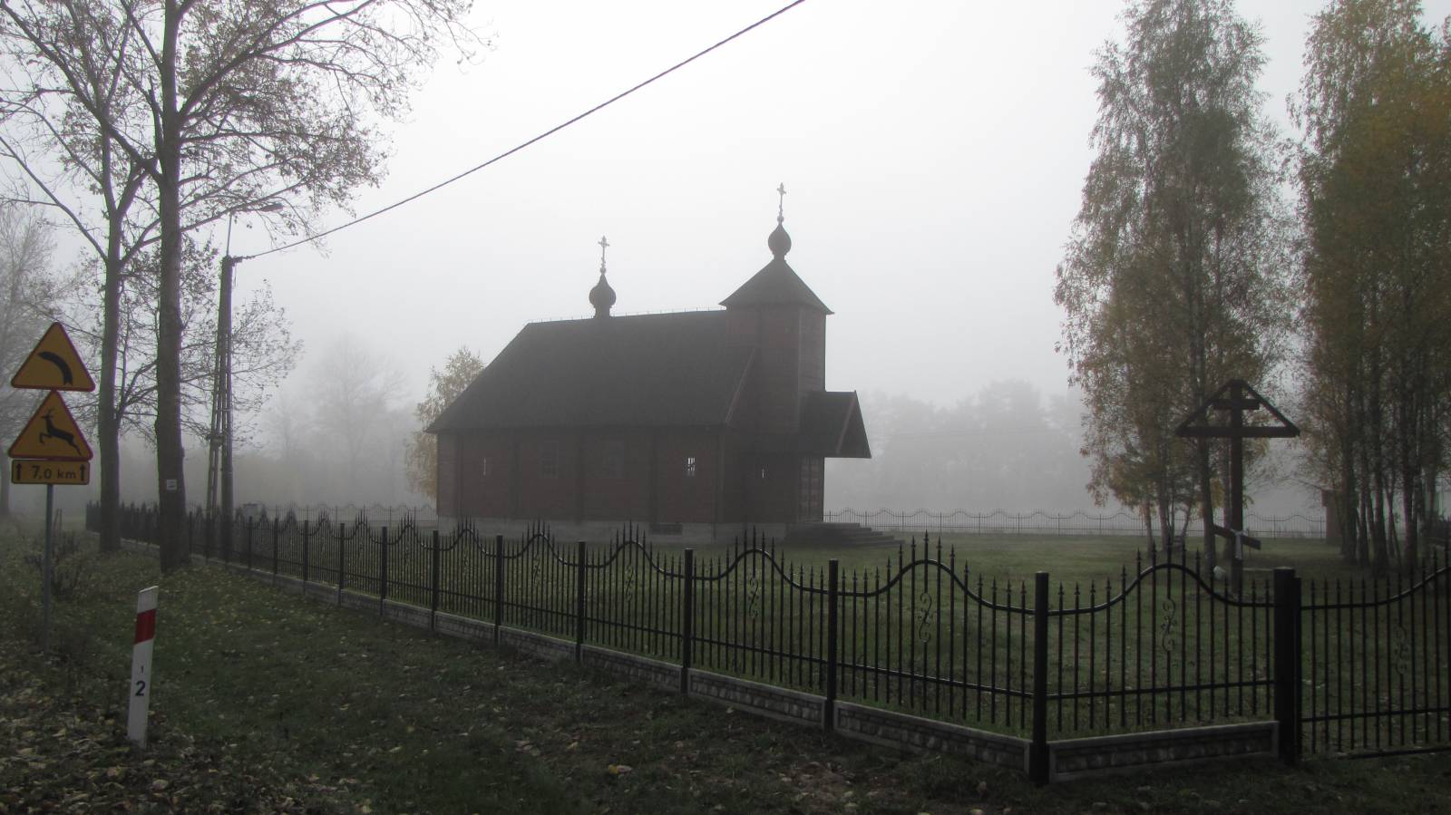
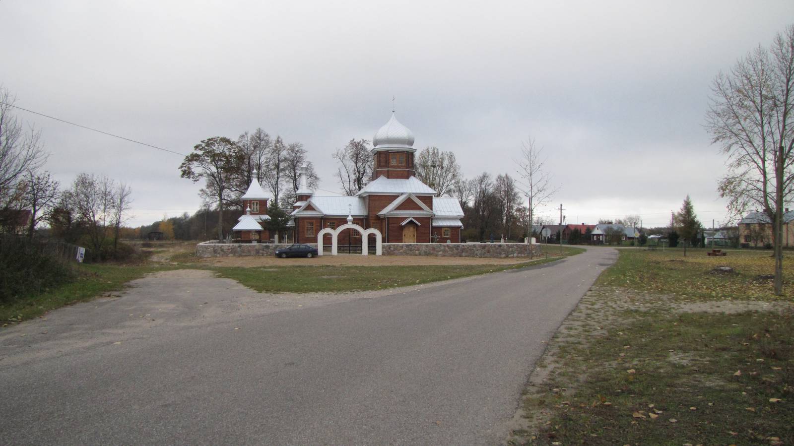
The trail begins in the centre of Siemiatycze. This town gives you an opportunity to see numerous religious monuments of several faiths, which have co-existed here for centuries in harmony, side by side. These include the church of the Assumption of the Blessed Virgin Mary from the 17th century, the Orthodox church from the 19th century, the monastery of the missionaries, as well as a small synagogue and a large synagogue from 1795, currently a culture centre. The heyday of Siemiatycze was the second half of the 18th century, when it was owned by Duchess Anna Paulina Jabłonowska, née Sapieha – a reformer of the times dedicated to field cultivation, forestry, beekeeping, practicing law, as well as running her household. From Siemiatycze, the trail goes east, in the direction of the Bug. It passes the railway station situated over 7 kilometres away from the town, turning to the south, into the river valley. That’s where the prettiest section of the trail begins. Along the river, the trail follows good roads with a hard surface and little traffic. As you pedal, you can see concrete bunkers. Those are remnants of Soviet fortifications known as the Molotov Line. The trail goes on to Mielnik, one of the region’s most important towns in the past. The most important historical site in the area is the Castle Hill (Góra Zamkowa). Towering over 80 metres above the level of the river, there is a steep hill with a fortified settlement from the 11th century and a viewing point. It was here that the Polish-Lithuanian Union of Mielnik was signed in 1501. The castle on the hill was burned down during the Swedish Invasion. Among the religious monuments in Mielnik, one will find the ruins of the Catholic parish church of the Holy Trinity, a church from the 20th century, a 19th century Orthodox church and a small synagogue from the mid-19th century. In the northern part of the town, one can see an open-pit chalk mine, still in operation. It is the only such mine in Poland. The Mielnik Land History Centre (Ośrodek Dziejów Ziemi Mielnickiej) presents some interesting exhibits and an exhibition on the history of Podlasie. After Mielnik, the trail leaves the valley of the Bug and delves into vast forests. In their midst, in the vicinity of the village of Adamowo, you can see a massive complex of buildings. It is an oil pumping station for oil transmitted from the east via the “Przyjaźń” (“Friendship”) pipeline. The trail then approaches the border via regional road no. 640 which comes to a dead end before the border. From here, the trail turns north and leaves the forests. In villages along the way, Tokary and Zubacze, one can encounter historic wooden Orthodox churches. The area is very quiet, because the villages in this part of the region are located among vast forests, close to the border with Belarus, away from busy roads and cities. After the village Zubacze, the trail again enters the woods, and continues in their midst all the way to Czeremcha, where it ends. The latter is an important historical railway hub, located on the edge of the Białowieża Forest. In the late 19th century, this was part of the freight railroad from Odessa to Königsberg (today’s Kaliningrad). The village was founded in 1905 at a junction of strategic railway lines. Now, you can see museum exhibits related to the history of rail. There is an international rail border crossing with Belarus here, and in nearby Połowce, there’s a modern terminal for car traffic.You can return to the starting point by taking a Green Velo trail passing through Nurzec and Grabarka. This gives you the chance to see the Holy Mount of Grabarka, Poland’s most important sanctuary for Orthodox Christians. The distance from Czeremcha to Grabarka along the Green Velo trail is 36 km, and Siemiatycze is a further 9 km away, if you take the road to Boratyniec Laski. Such a loop has a total length of a little over 100 km, which corresponds to the distance of a two-day bike trip. This part of Green Velo features a lot of dirt roads and a few hills, so the route is a little harder than asphalt roads which the trail uses for most of the blue trail.
Points of interest along the trail:
- Siemiatycze - religious monuments, urban layout
- Bug River Valley - vistas
- Fortifications of the Molotov Line (concrete shelters)
- Mielnik - chalk mine, religious monuments, Góra Zamkowa, Melnik Land History Centre
- Orthodox churches, shrines, wayside crosses, wooden architecture in villages along the trail
- Czeremcha - religious monuments. The entire trail is suitable for bicycles with panniers/bike trailers.
The trail uses solely roads with no motor vehicle traffic allowed or local roads with a low and very low vehicle traffic; no dangerous intersections. Recreational character. Trail of outstanding cultural heritage value.
Starting point:
Siemiatycze, PKS bus station
Finishing point:
Czeremcha, railway station