
 Highest point
 Lowest point
 Sum of driveways
 Sum of downhill
 High slope sections
 Slope
Slope Marking
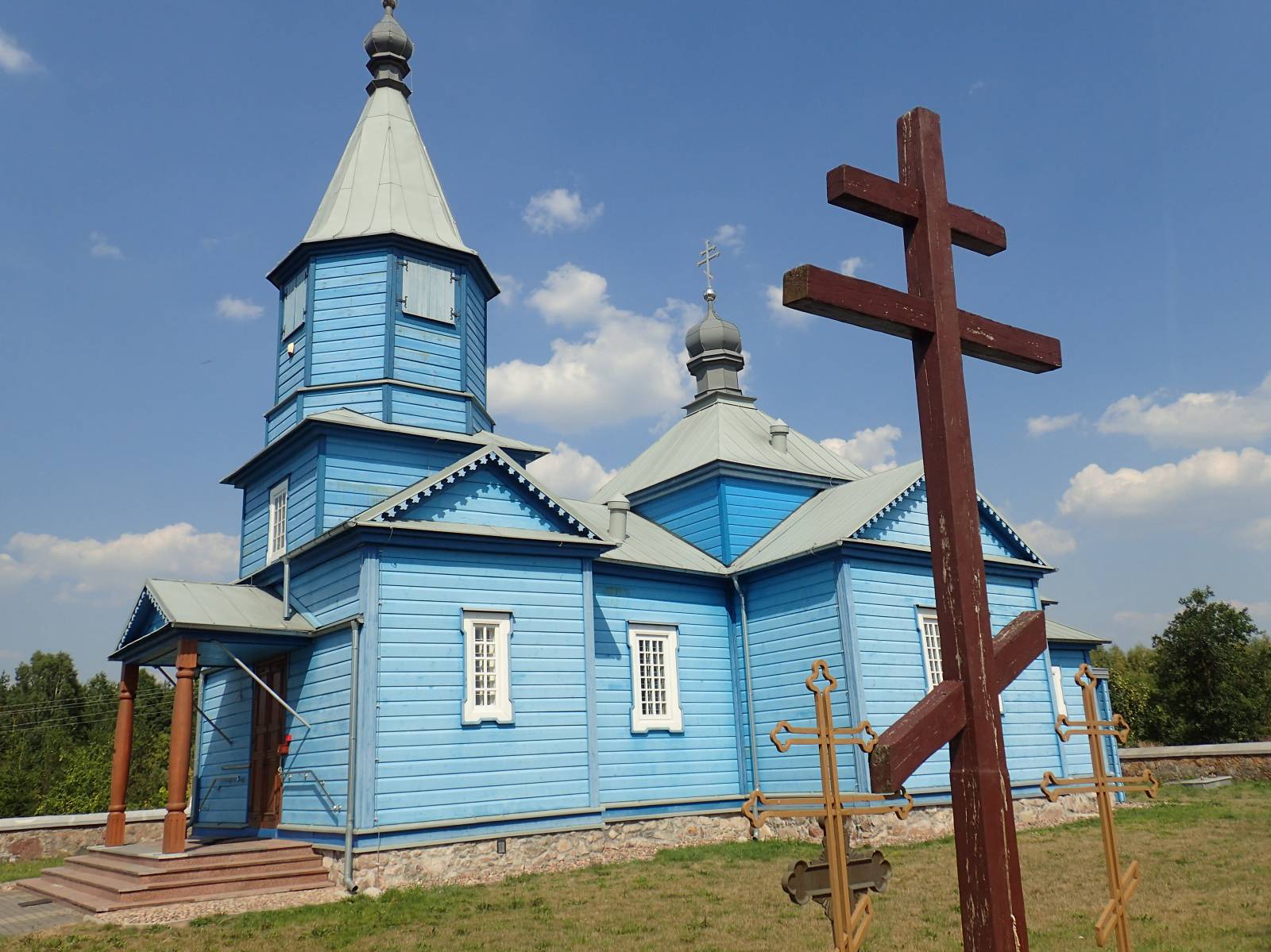
As its name suggests, the Juchnowiec Municipality Bicycle Ring-road bypasses this municipality between Białystok and the Narew Valley. This quite long (over 50 km) route is rather flat and almost devoid of steep inclinations.
The general route of the trail is as follows: Białystok, near the Białystok-Krywlany Airport (0.0) - Stanisławowo (5.6 km) - Narew behind the village of Wojszkiy (26.1 km) - Kożany, Orthodox church (31.3 km) - Juchnowiec Kościelny (44.3 km) - Niewodnica Kolonia (52.0 km).
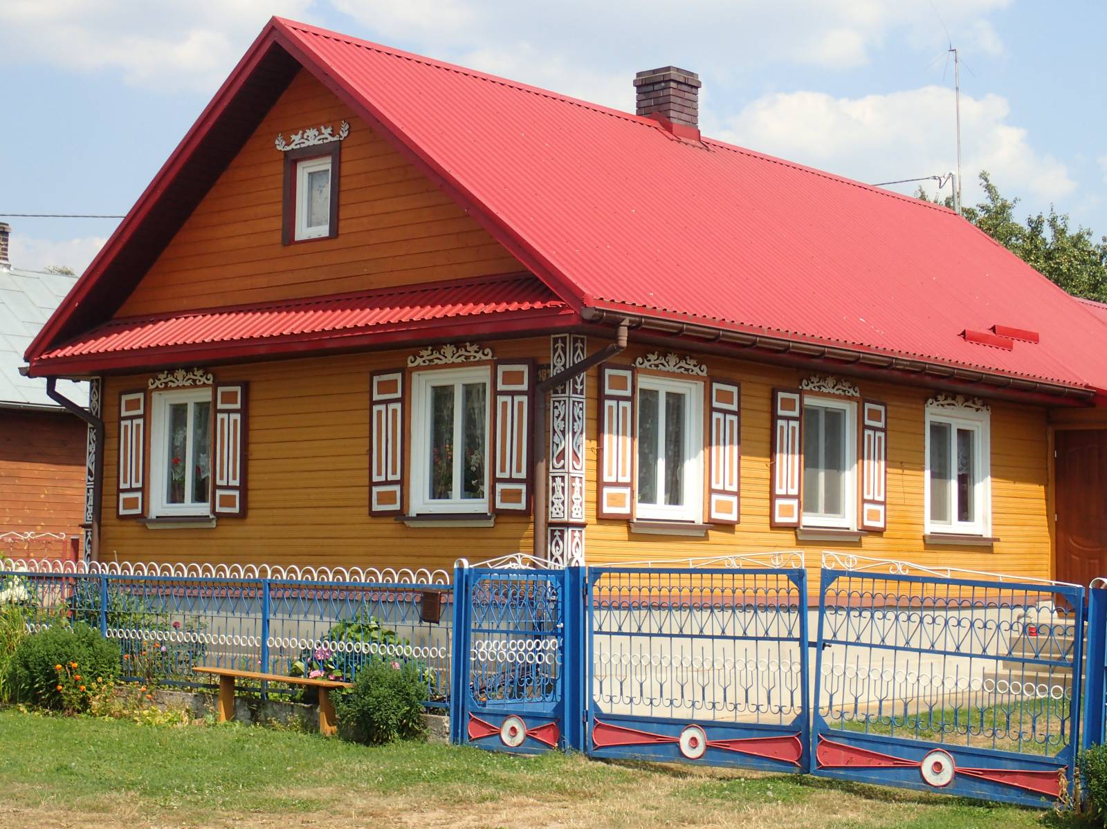
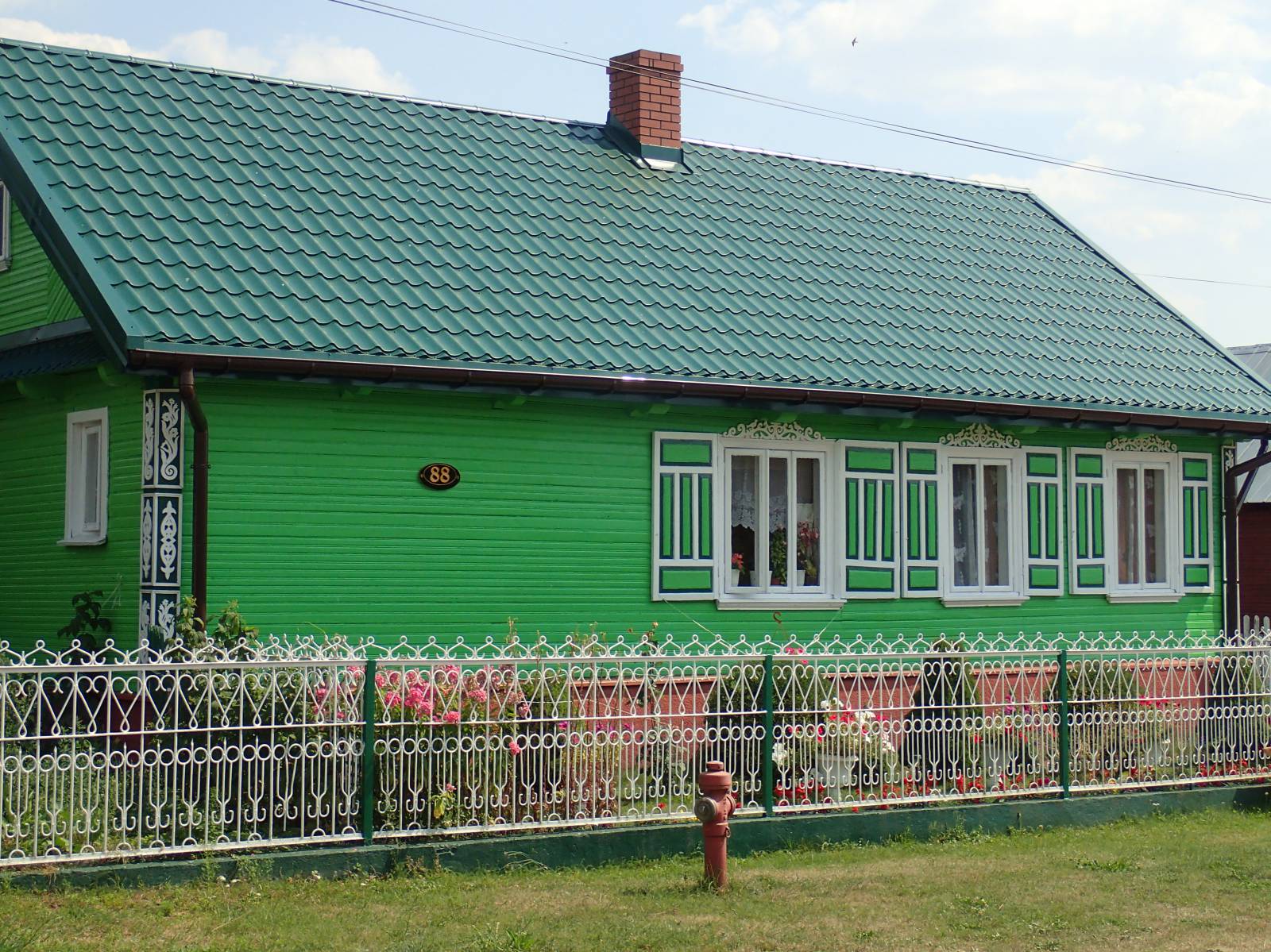
The route goes from the outskirts of Białystok to the south, first through the suburban Solnicki Forest, near the local airport. Then it continues on a plain gently sloping toward the Narew Valley, through vast fields and meadows of the southern outskirts of Białystok. The main attraction are the numerous monuments of rural architecture, traditional for Podlasie, such as richly decorated, old cottages, and colourful churches and shrines. The most interesting place on the trail is Wojszki, an old village with an Orthodox church and many beautiful old wooden houses. Almost all of them are intricately decorated with carved and painted details of doors, quoins, and shutters. Another curiosity along the trail is the late 19th century Orthodox Parish Church of the Exaltation of the Holy Cross in Kożany. It is one of the most beautiful countryside churches in Podlasie, painted in a beautiful blue colour. The interior has a truly mystical atmosphere, while the church itself is situated in a park surrounded by a stone wall. As it approaches the Narew, the trail turns to west, and follows the river valley for around 6 km, up to the village of Czerewki. This part of the trail is more forested and quite sandy. After crossing the Mieńka creek, it turns around to head north and goes back towards Białystok through the Juchnowiec municipality, to the village of Niewodnica Korycka located by the road from Białystok to Łapy. From the place where the trail ends, around 6 km along provincial road no. 678 remains to reach its start. The trail is fairly well marked and uses mainly paved roads, which, however, see considerable car traffic. For this reason, it should not be recommended for family trips. The relatively long distance and sandy stretches, especially in the Narew Valley near the village of Zajączki make this trail more suitable for cyclists who are in good shape.
Points of interest along the trail: 1. Białystok (tourist attractions)
- The Narew Valley - vistas
- Wooden rural architecture - old, richly decorated cottages
- Orthodox churches and shrines
- Countryside landscapes of the area between the Knyszyn Forest and the Narew Valley
Not all fragments of the trail are suitable for bicycles with panniers/bike trailers. The trail uses (in its entirety or in part) roads with average traffic volume. There is at least one dangerous intersection (with no bicycle crossing or traffic lights); probably not recommended for families with children. Recreational character. Trail of outstanding cultural heritage value.
Starting point:
Białystok, intersection of ul. Ciołkowskiego and Wiosenna (Solnicki Forest near the airport)
Finishing point:
Niewodnica Korycka, intersection of ul. Mazowiecka and Przemysłowa