
 Highest point
 Lowest point
 Sum of driveways
 Sum of downhill
 Marking
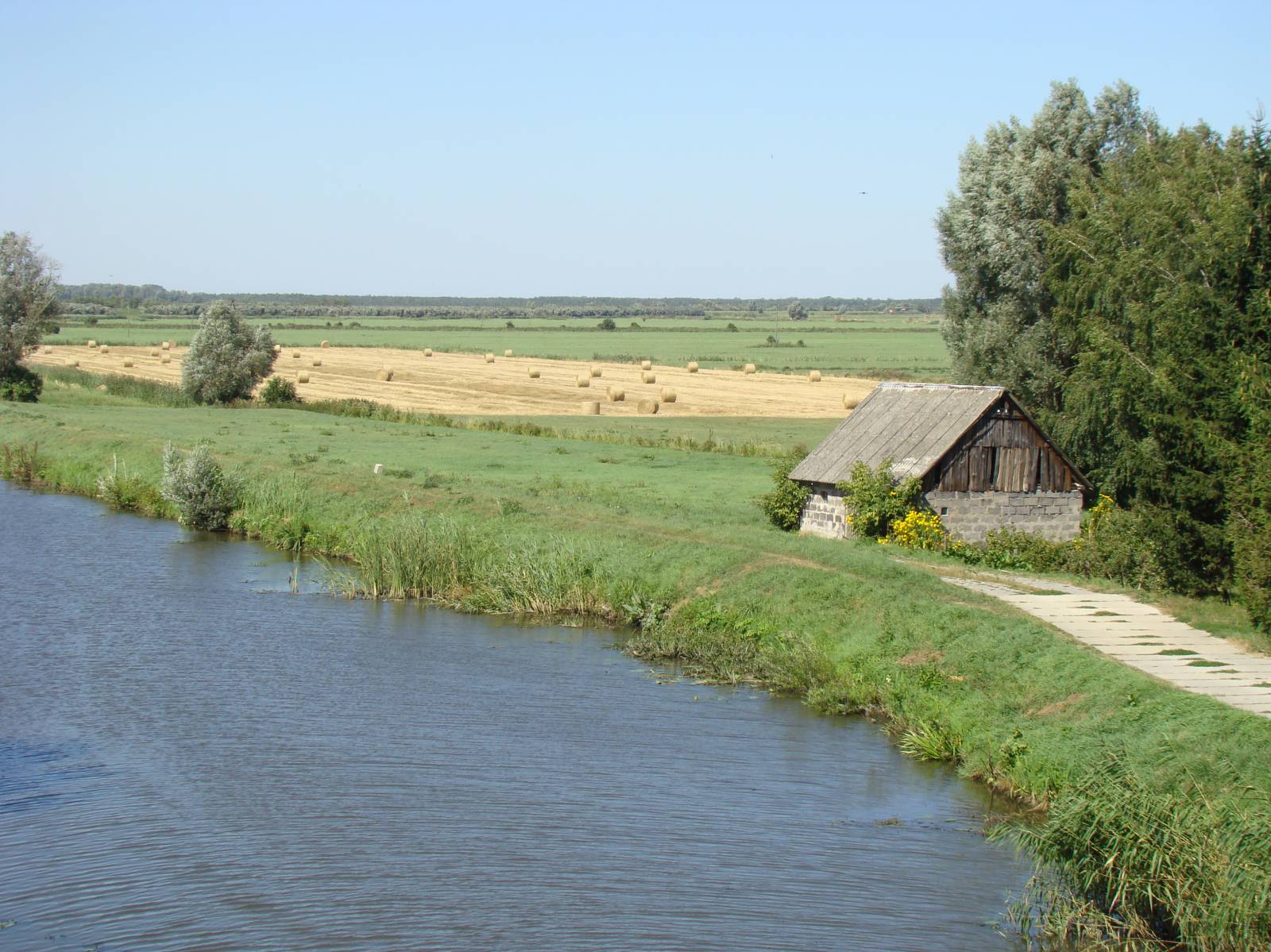
This 45 km long trail goes around the largest lake of the Żuławy Wiślane area. Overgrown with reeds, Lake Drużno is a great mainstay of waterfowl. The trail passes near the lowest point in Poland (Raczki Elbląskie, -1.8 m). The ride includes going on roads paved with reinforced concrete road slabs known as JOMBs, used for roads in the area that go through swamps. Due to the fact that this is a wetland, some of the slabs have sunk, which makes the bike ride quite arduous. That is why for this trail mountain bikes with good shock absorbents are recommended. The trail goes through terrain typical of Żuławy Wiślane, open spaces devoid of trees, so on windy days you should expect an additional nuisance due to wind. The route features numerous information boards and markings are very good. You can buy basic food products in small village shops along the way. This trail is recommended for lovers of the architecture and landscapes of Żuławy Wiślane, who don’t mind riding on surfaces that pose a challenge.
The general route of the trail is as follows: Elbląg, national road no. 22 west of the city (0.0 km) - Raczki Elbląskie, lowest point (1.7 km) - Węgle-Żukowo (9.7 km) - Wiśniewo (18.5 km) - Stankowo (25.8 km) - Węzina (41.4 km) - Komorowo (45.4 km).
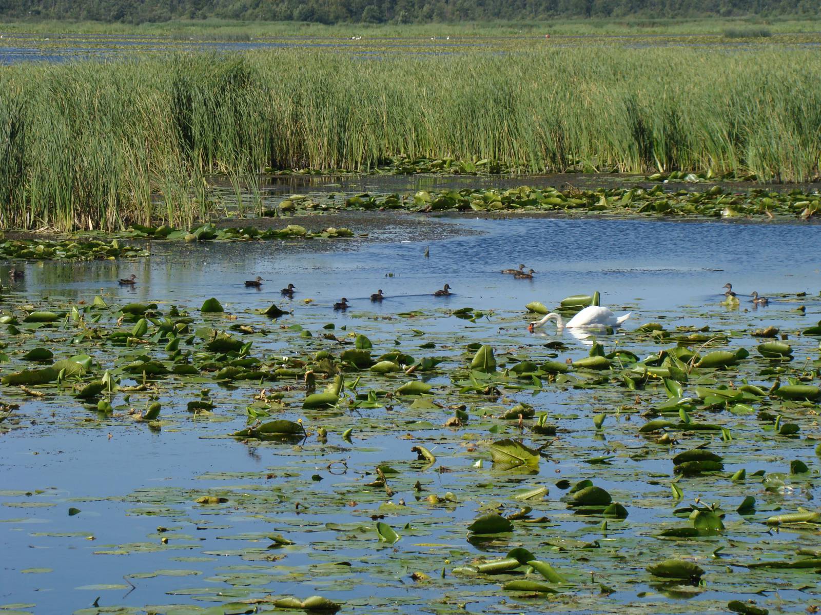
The trail starts near the second largest city of the Warmia-Masuria Province, that is Elbląg. It is from the name of this city that the region takes its name, Żuławy Elbląskie. Elbląg is the oldest town in the Warmia-Masuria Province. It was granted a charter in 1246, as one of the first towns chartered by the Teutonic Order. Until the construction of Malbork Castle, it was the most important town of the Teutonic Knights in Prussia. Elbląg’s rapid development between the 12th and 17th centuries had to do with its membership in the Hanseatic League. Granary Island, located on the left bank of the Elbląg River, used to be the town harbour’s supply base with its warehouses and granaries. After centuries of continuous growth since the Middle Ages, the town was almost completely devastated in 1945. Luckily, the most valuable Gothic monuments survived: the St. Nicholas Cathedral, the Dominican Church, the hospital of the Holy Spirit and the Market Gate (Brama Targowa). Meticulously restored, they are part of the Old Town complex, whose reconstruction has been going on for years. Elbląg’s rich archaeological legacy can be seen in full if you visit the local museum of archaeology and history. The beginning of the trail is located in the immediate vicinity of the lowest point in Poland in Raczki Elbląskie. At this point, the terrain is almost 2 metres below the sea level, so the trail can be jokingly referred to as “depressing”. The trail goes through a landscape that is typical here: entirely flat. Along the road, you can see a few historic timber-frame houses with porticos over the entrance (known in German as “Vorlaubenhaus”), built by the Dutch Mennonite settlers. Another attraction are simply the views of the lake itself, particularly interesting for bird lovers. It is difficult to accurately determine the exact area of this shallow body of water, lying almost at sea level, but it is more than 1000 hectares. The lake, crossed by the Elbląg Canal trail, provides refuge for marsh-dwelling birds. The trail ends in Komorowo Żuławskie near the S7 Gdańsk-Elbląg national road, on the edge of the Elbląg Upland. From there, you can take the S7 to return to Elbląg safely or opt for a part of the green “Postilion Trail” (Szlak Pocztyliona) that climbs up to the edge of the Elbląg Upland, offering a panoramic view of the entire lake from the top. Both routes will not exceed 10 kilometres to the city limits, so the total distance of the trip will be 60 km (counting from the train station).
Points of interest along the trail:
- Drużno Lake - the biggest body of water in Żuławy Wiślane and a waterfowl refuge protected under NATURA 2000
- Elbląg-Ostróda Canal, passing through Lake Drużno
- Raczki Elbląskie - the lowest point in Poland: -1.8 metres (marked)
- Mennonite monuments - arcaded houses, cemeteries (the largest one in Markusy)
Not all fragments of the trail are suitable for bicycles with panniers/bike trailers. The trail uses solely roads with no motor vehicle traffic allowed or local roads with a low and very low vehicle traffic; no dangerous intersections. Trail for fans of mountain and off-road biking.
Starting point:
Elbląg, near the junction of national roads no. 22 and S7
Finishing point:
Komorowo Żuławskie