
 Highest point
 Lowest point
 Sum of driveways
 Sum of downhill
 High slope sections
 Connected with GreenVelo
 Slope
Slope Marking
Spanning 18 kilometres and passing over the Elbląg Upland hills near Elbląg, this is one of the shorter trails. Using part of the Green Velo trail, it goes mainly through forests and villages outside of Elbląg. The marking is fairly worn out, and due to the road surface, MTBs are recommended. The trail has the character of a suburban recreational route. Due to the slope of the terrain, the recommended direction to go is to start in Elbląg and head in the direction of Jagodnik. Thanks to this, the second part of the trip will be going downhill towards the Vistula Lagoon for the most part.
The general route of the trail is as follows: Elbląg, near the animal shelter (0.0 km) - Dąbrowa forest district (1.6 km) - Jagodnik, edge of forest (5.0 km) - Martwe Lake (7.5 km) - Jelenia Dolina (10.3 km) - Próchnik (11.5 km) - Rubno Wielkie (17.4 km).
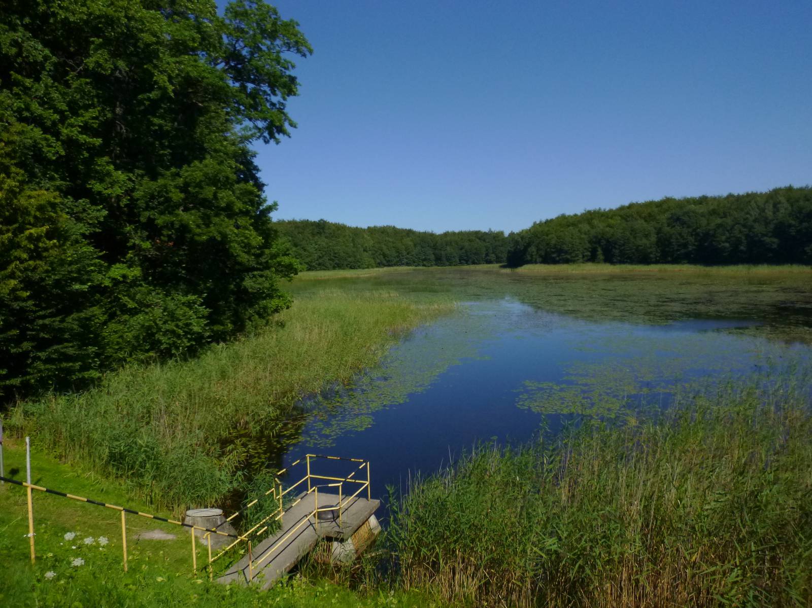
The trail starts near the second largest city of the Warmia-Masuria Province, that is Elbląg. The forested upland area through which the trail passes is protected as the Elbląg Upland Landscape Park (Park Krajobrazowy Wysoczyzny Elbląskiej). The park covers an area of 13.7 thousand hectares. It was created in order to protect the nature and landscapes of the moraine hills, formed during the last ice age. The area features unique vegetation typical of mountainous terrains, such as the ostrich fern, protected in the “Pióropusznikowy Jar” nature reserve. Another peculiarity of the park are the East Asian sika deer that live here. They were introduced in 1895 as a gift of the Russian Tsar Nicholas II for the German Emperor Wilhelm II, famous for his love for hunting. From the suburbs of Elbląg, the trail delves into the forests of the Elbląg Upland, near the Bażantarnia city park, and goes to the village of Jagodnik, coming across a Green Velo trail. Jagodnik stands out of the surrounding localities with its 115-metre mast of the Radio and Television Broadcasting Centre. At this point, the trail leaves Green Velo and crosses meadows (note, at times the trail loses continuity), passing by a small body of water called Martwe Lake with a small beach. Then it heads west, to the villages of Jelenia Dolina and Próchnik. From there, the trail goes downhill through forests to provincial road no. 503 and the railway line along the Vistula Lagoon.
Points of interest along the trail:
- Elbląg - city monuments
- Elbląg Upland Landscape Park
- Forest lakes and ponds
Not all fragments of the trail are suitable for bicycles with panniers/bike trailers. The trail uses solely roads with no motor vehicle traffic allowed or local roads with a low and very low vehicle traffic; no dangerous intersections.
Starting point:
Elbląg, ul. Królewiecka (near the animal shelter)
Finishing point:
Rubno Wielkie near Elbląg, provincial road no. 503