
 Approximate driving time with sightseeing
 Highest point
 Lowest point
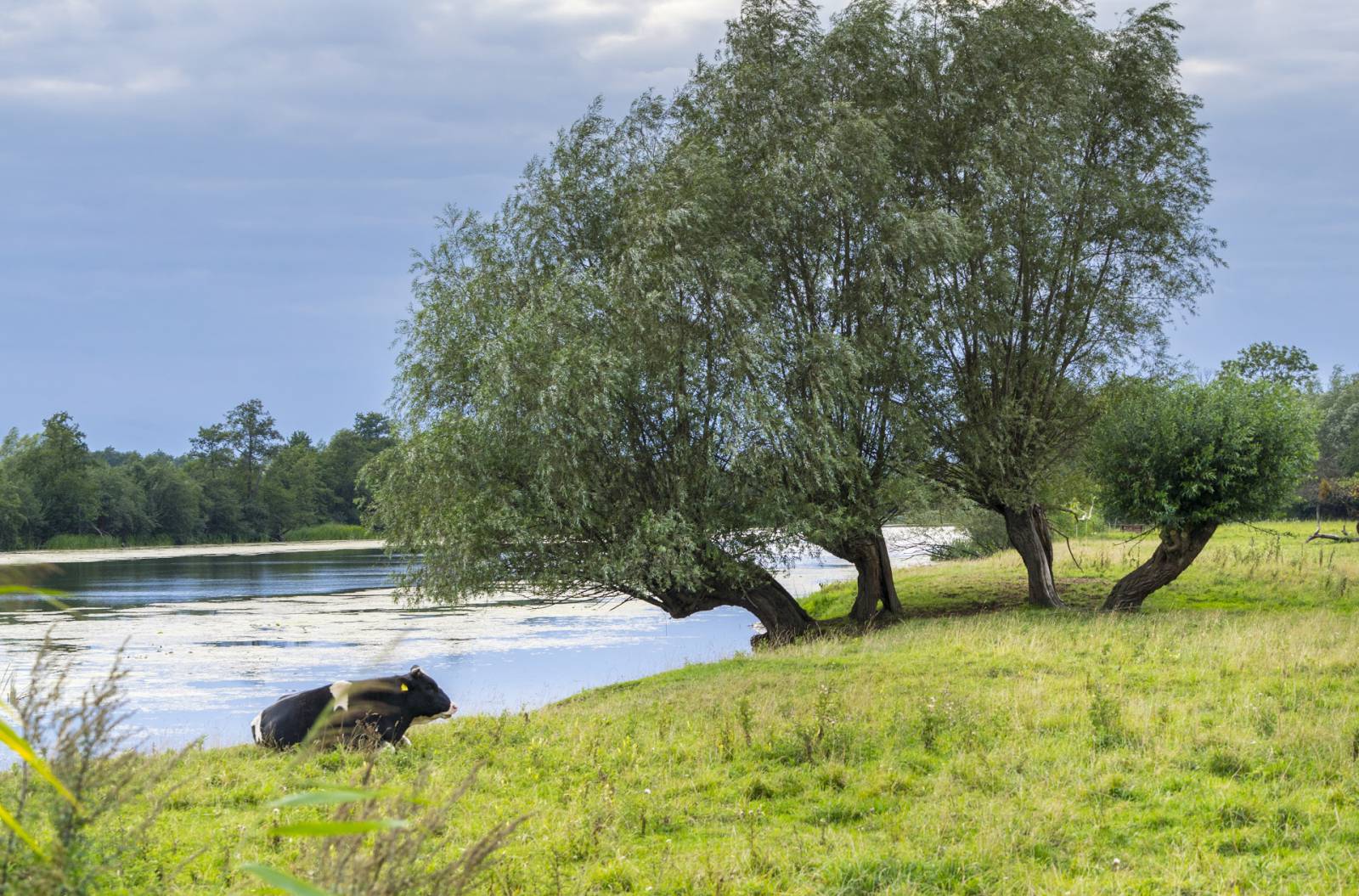
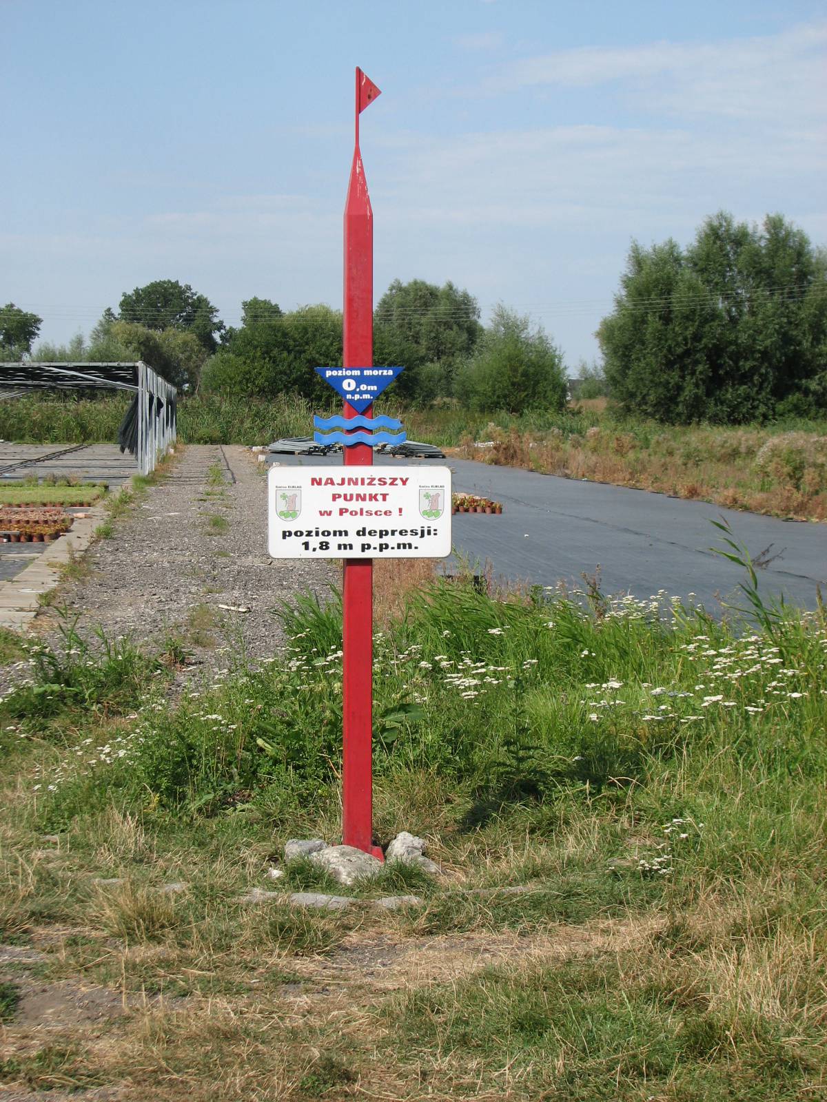
The trip starts in the outskirts of Elbląg, close to the Elbląg-Południe road junction, and fully runs through the territory of Żuławy Wiślane along the blue cycling trail. The first section of the trail leads to the Raczki Elbląskie village. Here you can come across the lowest natural depression area in Poland (1.8 m below sea level). This peculiar land arrangement can be observed from dams on the shore of Lake Druzno, the bottom of which is also situated below sea level in a cryptodepression. Past Raczki Elbląskie, the trail approaches the shore of Lake Druzno – a former sea bay. Along with the surrounding shoreline, the lake currently serves as a nature reserve. Its depth is 2.5 m, and the fairway of the Elbląg Canal leads through its centre. Because of occasional backflows of Baltic water from the Elbląg Bay, the salination of the lake is low. The trail leads farther around the lake. It is worth noting the building arrangement of villages being passed on the way. It is very orderly, with some of the houses standing on terps – artificial elevations created to reduce the risk of flood. During the trip, you can also observe drainage devices that help protect the Żuławy region against floods. Close to the Żółwiniec village, there is an observation tower, from which a view of the surrounding area spreads out. You can see from it the Elbląg Plateau, which is situated almost 200 m a.s.l., the tower of the Church of St. Nicholas in Elbląg (95 metres high) and the church in Przezmark. In Dzierzgonka, there is a historic swing bridge on the Dzierzgoń river, which was used until the 1970s. The bridge is one of the three objects of this kind in the neighbourhood. The other two are railway bridges situated in Elbląg and Rybina. The last section of the trail runs close to Janów. Near the village, Truso – a legendary seaside trading settlement described by the traveller Wufstan in the 9th century, which served as a centre of trade with Prussians – was discovered at the end of the 20th century. The trip ends near the railway station in Komorowo Żuławskie. From there, you can return to Elbląg by train or bike.
Trail option (57.2 km):
From Komorowo Żuławskie, you can return to Elbląg by the old road no. 7.
Surface and marking of the trail:
MARKED TRAIL
Most of the trail runs on asphalt and concrete slab roads; there are also short sections with cobblestone and gravel surfaces. The trail overlaps with the blue PTTK trail.
Attractions on the trail:
- The lowest situated point of Poland in Raczki Elbląskie
- Lake Drużno Reserve
- Swing bridge in Dzierzgonka
- Observation tower in Żółwiniec
Course of the trail:
- 0 km – Elbląg
- 4 km – Raczki Elbląskie
- 7 km – Jurandowo
- 5 km – Żółwiniec
- 1 km – Dzierzgonka
- 26 km – Stankowo
- 42 km – Węzina
- 7 km – Komorowo Żuławskie
Tourist Information Point in Elbląg
- Stary Rynek 25, 82-300 Elbląg, phone 55 23 93 377