
 Highest point
 Lowest point
 Sum of driveways
 Sum of downhill
 High slope sections
 Connected with GreenVelo
 Slope
Slope Marking
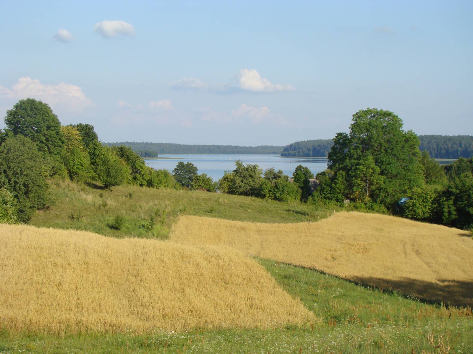
The Antoni Patla route is a cycling trail that runs around WigryLake. It is one of the most interesting trails in Poland that offers some of the most beautiful views. It was marked out in the territory of the Wigry National Park, mainly through fields and forests surrounding the beautiful Lake Wigry. The length of the route (nearly 60 km) and the varied terrain makes the route suitable for people who are in good shape, using rather mountain bikes. The sum of ascents and descents is 600 meters, which means that the height difference is about 1% of the total route length.
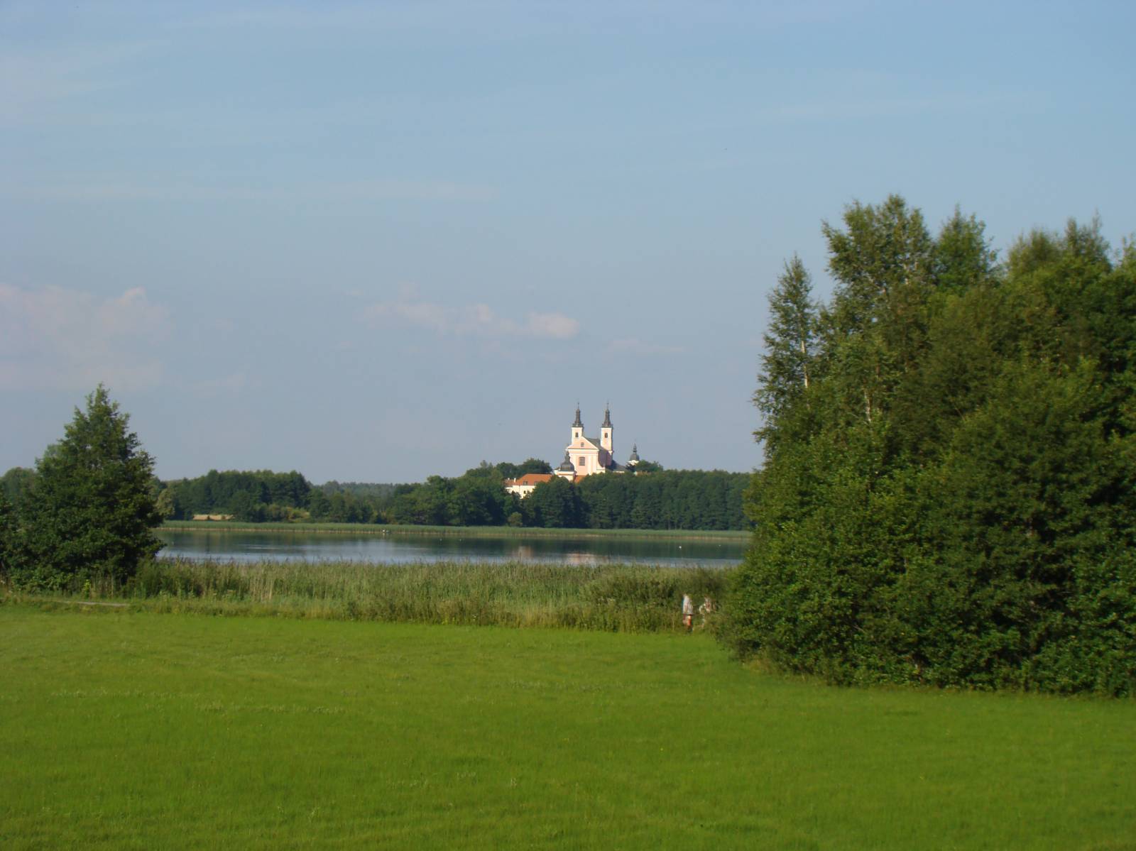
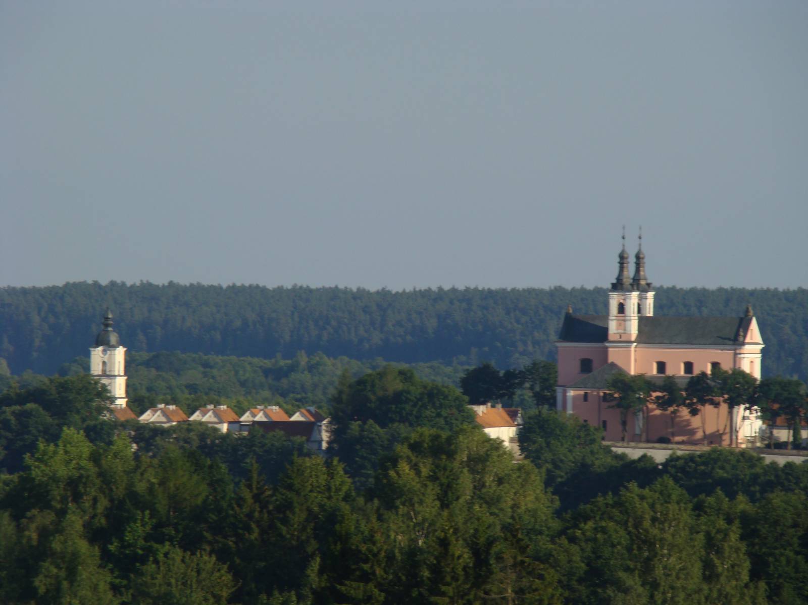
The route is extremely picturesque and well-signposted. It has been equipped by the administration of the National Park with numerous resting places, information boards and vantage points. The crown jewel on the trail is of course the Camaldolese monastery, located on the peninsula in the northern part of the lake. The trail has the shape of a loop surrounding the lake, and one of its elements is an access road to and from the locality of Krzywe, where the management office of the National Park is located.
The trail was named after Antonia Patla, the most meritorious social activist, teacher, journalist and touring expert for the region of the Augustów Lake District and the Suwałki Region, who was one of the initiators of nature and culture protection in these areas. Antoni Patla lived in 1898-1977, and during World War II he was a member of the resistance movement. Before and after WWII he actively participated in the life of this region, popularizing tourism in the whole area acting as an activist of the Polish Sightseeing Society (PTK), and then of the Polish Tourism and Sightseeing Society (PTTK). Currently, these traditions are continued by many institutions, including the Wigry National Park that is the trail administrator.
The surface of the route varies a great deal. The section between the localities of Krzywe and Tartak runs on an asphalt cycling path, which is one of the investments covered by the Green Velo route. The further part, running around the lake, are mainly dirt roads and forest tracks, with local asphalt roads here and there. There are sections quite tough due to ascents and narrow paths and little paths, fortunately without sand. Variety is provided by long wooden footbridges through brooks and swamps. All this makes the trail varied a great deal, but also quite tiring for a less skilled cyclist.
The general course of the trail is as follows: Krzywe, the management office of the Wigry National Park (0.0) - Stary Folwark, Wigry Museum (5.0 km) - Wigry, turn to the monastery (8.3 km) - Red Cross (19.0 km) - Płociczno-Tartak (34.1 km) - Stary Folwark (50.0 km) – Krzywe Wigry National Park (57.3 km).
The loop around the lake (without access to - and from the locality of Krzywe) is 46 km long. You can also shorten the route a bit, cycling from the locality of Stary Folwark (the Wigry Museum) westwards straight to the locality of Krzywe.
Key points of interest along the trail include an ethnographic and natural exhibition at the national park's management office in the village of Krzywe, along with nearby nature paths leading to forest dead-ice lakes, the former Camaldolese monastery in Wigry, the Wigry Narrow Gauge Railway running from Płociczno to Tartaki, footbridges on the western shore of the lake, a beautiful view of the monastery from the vicinity of the locality of Stary Folwark and the local Wigry Lake Museum. However, the biggest advantage offered by this trail are beautiful views of Lake Wigry and the surrounding hills, covered with fields, meadows and forests. The extremely fragmented coastline of the lake looks different from every point of the trail.
To describe all the trail attractions, several pages would be required. It is best to equip yourself with a good guide to the National Park, because almost all of its key attractions are located along the route. Consequently, it is the best to divide this trip into two days. You can stay overnight in one of the villages located on the route - there are many inns and agritourism lodgings, as well as hotels.
Points of interest along the trail:
- Wigry National Park
- The locality of Krzywe - the headquarters of the National Park management, natural and ethnographic exhibition, footbridges over the swamps, educational paths, nearby dead-ice lakes
- The locality of Stary Folwark – The Wigry Museum
- Wigry - the Camaldolese monastery
- Viewpoints on Wigry Lake
- Footbridges over swamps
- Płociczno-Tartak - The Wigry Narrow Gauge Railway
Not all fragments of the trail are suitable for bicycles with panniers/bike trailers. The trail uses solely roads with no motor vehicle traffic allowed or local roads with a low and very low vehicle traffic; no dangerous intersections. A trail for lovers of mountain biking and off-road cycling. Trail with outstanding natural beauty. Trail with special qualities of cultural heritage. Trail offering outstanding vistas.
Starting point:
The locality of Krzywe, Headquarters of the Wigry National Park Management
Finishing point:
Krzywe, Headquarters of the Wigry National Park Management