
 Highest point
 Lowest point
 Sum of driveways
 Sum of downhill
 High slope sections
 Connected with GreenVelo
 Slope
Slope Marking
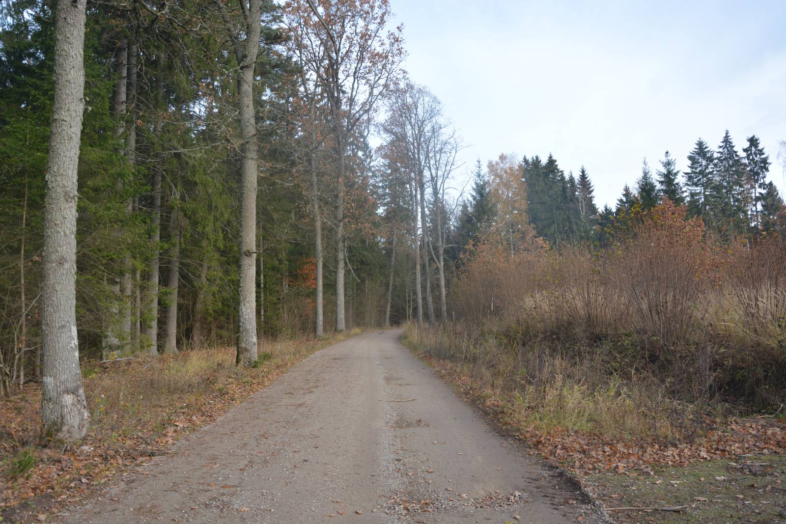
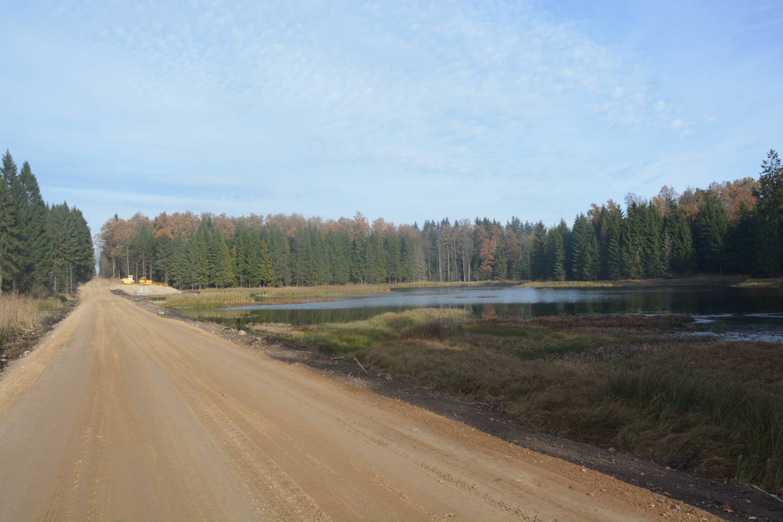
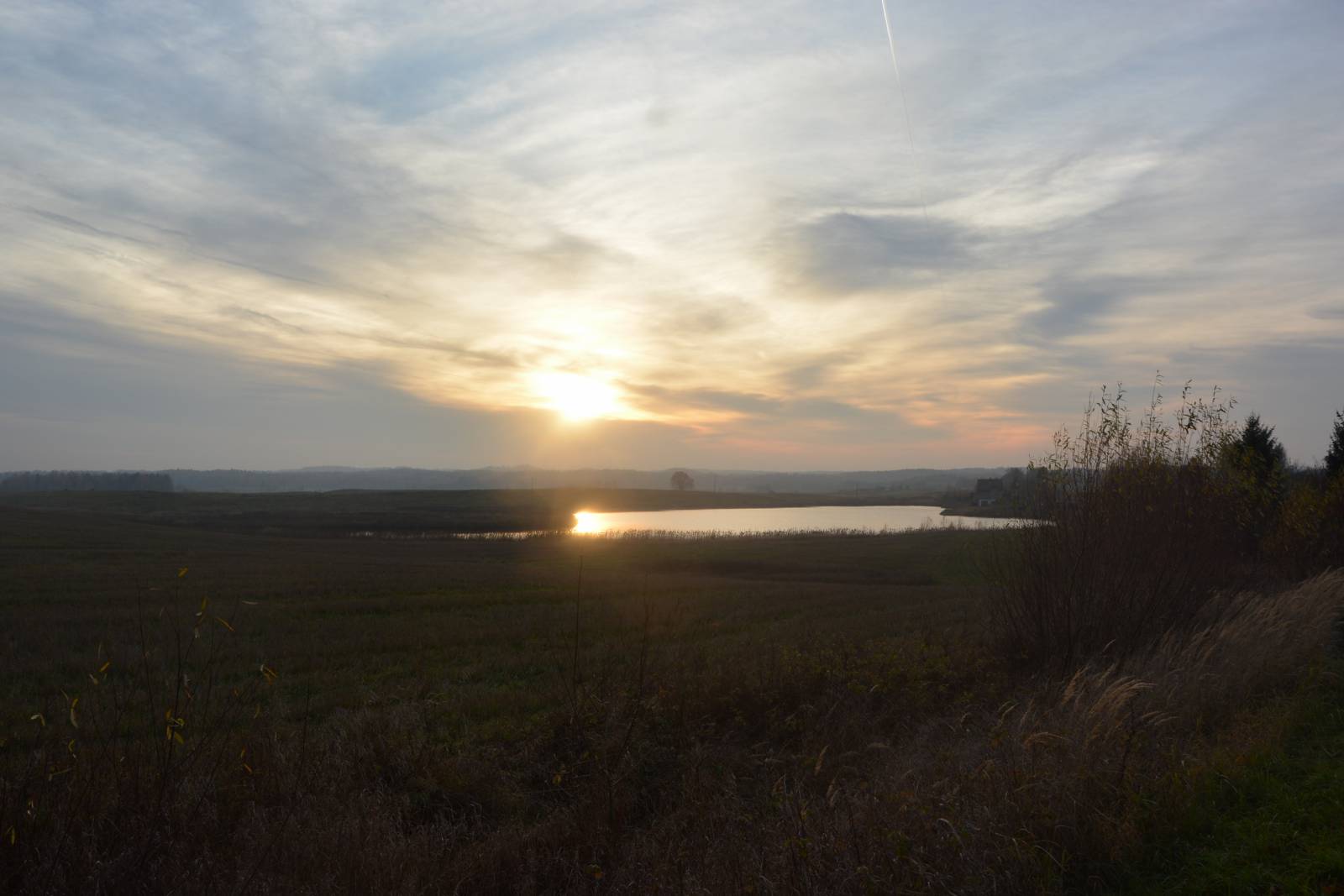
Spanning almost 80 kilometres, the red bike trail called the Rominta Deer Trail goes around the Romincka Forest (Puszcza Romincka). Most of the trail uses unpaved roads and forest firebreaks, usually of pretty good quality. This unusual trail shows the natural beauty of this frontier forest, which is Poland’s only boreal forest complex, or taiga. It also has some remarkable bridges of the former railway line, with the most famed ones in Stańczyki. The trail passes through the dark, spruce forests of the Romincka Forest and the scenic, hilly terrain of Mazury Garbate (lit. Hunchbacked Masuria). In its northern part, between Lake Gołdap and Żytkiejmy, the trail remains within the forest for more than 40 kilometres, except for some fields around Galwiecie. The woods have plenty of secluded spots, nature reserves, wetlands and streams. What reminds visitors of times past are “Wilhelm’s Stones” – boulders placed in spots where the German Emperor Wilhelm II, an avid hunter, shot “a capital roebuck”, that is, an excellent stag. It is from these stones that the trail got its name. The other great attraction of the trail are the bridges of the former railway line, the most famous ones in Stańczyki, and those less known in Botkuny and Kiepojcie. The trail passes next to several lakes and through many old villages, in which the traditional brick architecture, typical for Prussia, has survived. Due to the proximity of the border you should expect to be controlled by border guards and have your ID on you.
The general route of the trail is as follows: Jurkiszki (0.0 km) - Szyliny (2.9 km) - Ostrówko (12.8 km) - Galwiecie (14.0 km) - Czarnowo Wielkie (19.4 km) - provincial road no. 651 before Żytkiejmy (39.7 km) - Żytkiejmy (42.1 km) - Degucie (46.2 km) - Stańczyki (51.5 km) - Błąkały (54.3 km) - Bludzie Małe (58.2 km) - Kiepojcie, bridges (59.9 km) - Kiepojcie (60.8 km) - Dubeninki (63.0 km) - Zawiszyn (65.5 km) - Czarne (68.3 km) - Kociołki (72.6 km) - Botkuny, rail bridges (76.8 km) - Jurkiszki (79.8 km).
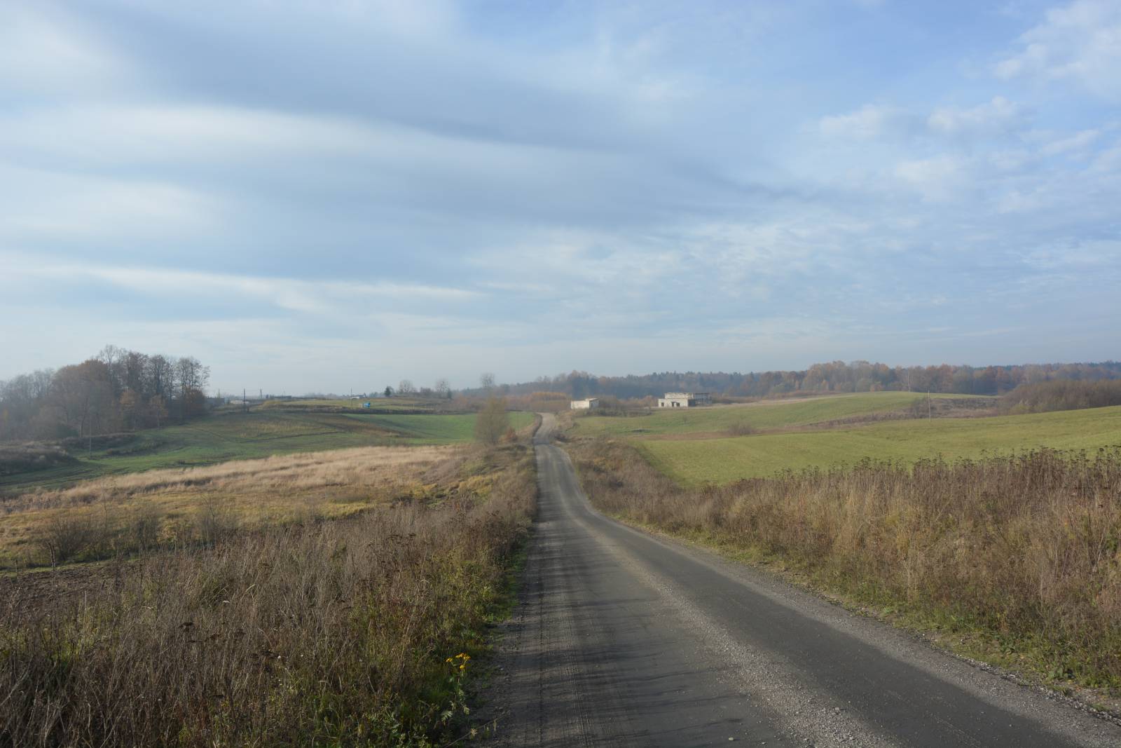
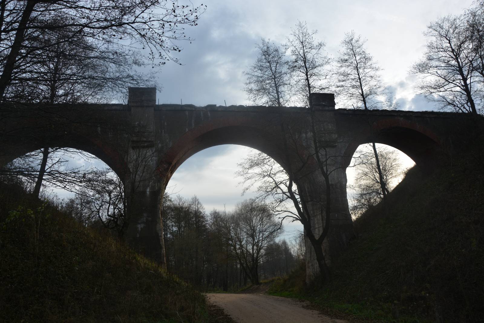
The trail begins and ends in the small village of Jurkiszki, located on the eastern edge of the Romincka Forest. From this place it is less than 5 km to the centre of Gołdap, via a Green Velo trail. Early on, the trail delves into the woods, and at first it heads north, near the large Gołdap Lake. Then the trail curves and approaches the border to return to the south, to the village of Galwiecie. There are two small lakes here. The bigger one of them, Ostrówek Lake, has a lookout tower and an educational trail next to it. Galwiecie is a good base for exploring the woods, as there are several agrotourism farms here and a manor house from the 19th century. After this village, the trail turns towards the border again and continues exclusively through the forests for 25 kilometres, with the tiny settlement of Czarnowo being the only exception. This part of the forest is the most pristine. It has numerous nature reserves, and the area is slightly rolling and tilts towards the east. Information about the surroundings and natural attractions of the area is displayed on boards found throughout the forest. Before the village of Żytkiejmy, the trail takes quite a busy road (no. 651) for several kilometres – it is the only paved road crossing the forest. Żytkiejmy is a large village on the edge of the forest and as such it is also the place where you can stock up during the journey. It is also home to the headquarters of the Romincka Forest Landscape Park. The village is situated on the former railway line to Gołdap, along which the next part of the trail will follow. From this point, the trail turns to the south and follows along the edge of the forest. Then, past the village of Degucie, it goes through the forest again until it reaches the most famous landmark on the trail, Stańczyki. The famous bridges found here are often referred to as “the Aqueducts of the North”. They rise 36.5 metres over the rapid stream of the Błędzianka River, while their length is that of around 250 metres. After the village of Stańczyki, the trail leaves the Romincka Forest and passes near large lakes, Przerośl and Czarne, going back to the area of Galwiecie through the villages of Błąkały, Kiepojcie, Zawiszyn and Czarne, situated in the beautiful, hilly, rural area of Mazury Garbate. The lakes are nice places to rest, and the largest village on the trail, Dubeninki, has the character of a small town. The surrounding area captivates the visitor with the beauty of the vast landscapes of fields and pasture interlaced with woods. Here and there you can also find reminders of the people who used to live in this area: old cemeteries, ruins of houses and commercial buildings, etc. Near the village of Kiepojcie, the trail passes under one of the surviving bridges of the decommissioned railway line. Halfway between the villages of Kociołki and Jurkiszki, the trail goes through the forest on old tracks, and passes runs through twin railway bridges which span the high banks of the Jarka River Valley. These are three-span concrete structures, about 40 metres long and 15 metres high. This is the last of the unique attractions of this route. The bridges in Botkuny are only 3 kilometres away from the starting point of the trail. Together with the ride and return to Gołdap, the loop is about 90 kilometres long. Due to the surface, hilly terrain and the number of attractions along the way, you might want to divide the trip into two days. Combining the trip with sightseeing of all the points of interest on the route and in its vicinity, as well as with relaxation on the lakes of the Romincka Forest is a must. As far as spending the night, you can opt for a tent or one of the agrotourism farms of which there are plenty around.
Points of interest along the trail:
- Romincka Forest Landscape Park
- Nature reserves in the Romincka Forest
- Stańczyki - bridges
- Botkuny -bridges
- Kiepojcie - viaduct
- Żytkiejmy, Dubeninki, Galwiecie: big, old, Masurian villages
- Old, ex-German rural buildings, old cemeteries and ruins of farm buildings
- Landscapes of Mazury Garbate
- Numerous lakes: Czarne, Przerośl and others
The entire trail is suitable for bicycles with panniers/bike trailers. The trail uses solely roads with no motor vehicle traffic allowed or local roads with a low and very low vehicle traffic; no dangerous intersections. Recreational character. Trail of outstanding natural beauty. Trail offering outstanding vistas.
Starting point:
Jurkiszki
Finishing point:
Jurkiszki