
 Approximate driving time with sightseeing
 Highest point
 Lowest point
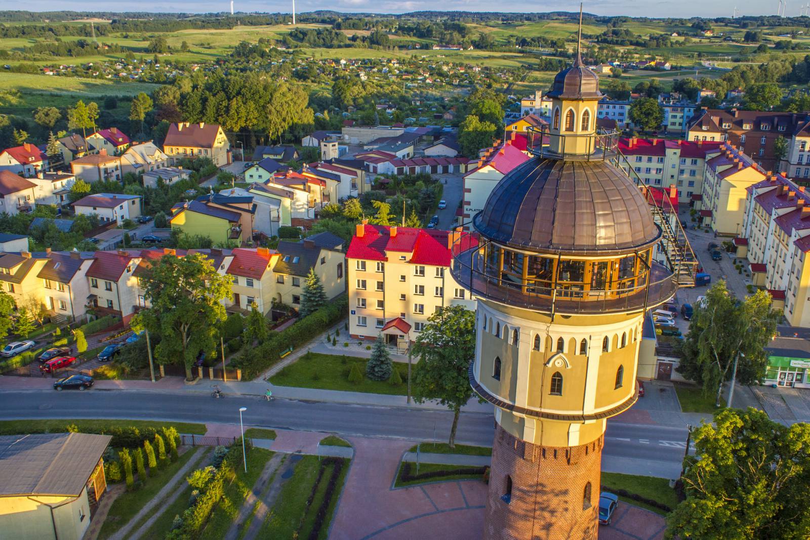
The trip starts in the resort town of Gołdap. In the town, there are brine water graduation towers, a salt cave and a mineral water pump-room. It is worth visiting local historic objects: the Gothic Church of the Blessed Virgin Mary Mother of the Church, the neo-Gothic Church of St. Leon and a water tower with a viewing terrace, as well as the Museum of the Gołdap Land with an exhibition devoted to the history and folk culture of the region, situated in the former military barracks. The trail of the trip leads through Szeskie Hills – the highest-located north-eastern part of the Masurian Lakeland stretching between Olecko and Gołdap. The highest point of the mountain range is Szeska Mountain (309 m a.s.l.) located near Szeszki south of the trail of the trip. The first section of the trail runs along the national road no. 650 and then turns left onto a local road. On the way, it passes the Piękna (Gołdap) Mountain, where a ski station functions in winter and leads farther towards Tatarska Mountain (308 m a.s.l.) – one of the higher elevations of the Szeskie Hills. On its peak there is a small lake protected along with the surrounding mires within the Torfowisko Reserve on Tatarska Mountain. In order to reach it, you must go a few hundred meters east of the trail of the trip. In the Zatyki village, there is an ecological farm breeding wild animals in an enclosure. A safari organised for tourists is an opportunity to see such animals as fallow deer, deer, wild yaks, llamas, or even zebras and camels. You can also sightsee the farm premises on a gondola or an amphibious vehicle. On one of the local ponds, there is an island with the reconstruction of a Yotvingian village. The return way to Gołdap leads down the slope of the elevation. On the northern and eastern side of the road, you can see the edge of the Romincka Forest – an extensive forest complex being a part of the Lithuanian Lakeland situated on the Polish-Russian borderland. Because of the raw climate of the region, the forest stand resembles a taiga.
Surface and marking of the trail:
The trail is not marked. The surface consists mainly of unsurfaced roads.
Attractions on the trail:
- Museum of the Gołdap Land in Gołdap
- Water tower in Gołdap
- Church of the Blessed Virgin Mary Mother of the Church in Gołdap
- Piękna Mountain – a viewing point and tourist complex
- Church of St. Leon in Gołdap
- Torfowisko Reserve on Tatarska Mountain
- Ecological farm – safari in Zatyki
Course of the trail:
- 0 km – Gołdap
- 1 km – Piękna Mountain
- 7 km – Tatarska Mountain
- 5 km – Pietrasze
- 5 km – crossroads to Zatyki
- 12 km – Zatyki
- 16 km – Kozaki
- 21 km – Gołdap
Tourist Information Centre in Gołdap, pl. Zwycięstwa 16, 19-500 Gołdap, phone 89 75 14 765, 89 61 52 090, poczta@frrg.pl