
 Highest point
 Lowest point
 Sum of driveways
 Sum of downhill
 Connected with GreenVelo
 Slope
Slope Marking
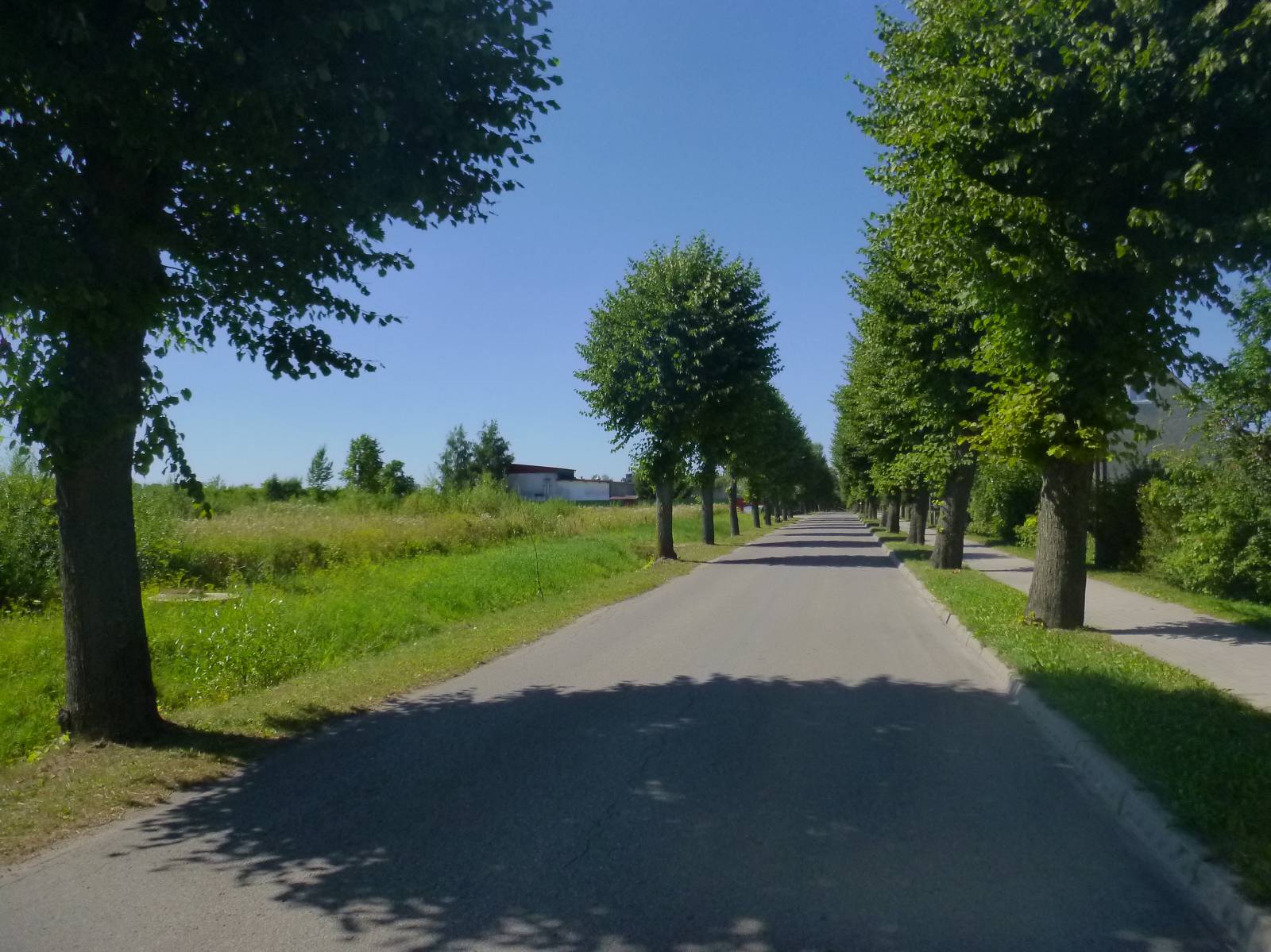
The blue trail in the Korsze municipality is one of four bike trails marked out near this town. It is just over 20 km long, it forms a loop, east of the village, running on good asphalt roads through a number of villages and settlements where very interesting monuments have been preserved. Near the trail there is the largest palace complex of Warmia and Mazury Region in Drogosz.
The general course of the trail is as follows: Korsze, station (0.0 km) - Glitajny (2.4 km) - Parys (5.3 km) – Pomnik (7.4 km) - Drogosze (8.9 km) - Warnikajmy (14.1 km) - Błogoszewo (16.5 km) - Olszynka (18.0 km) - Korsze (21.3 km).
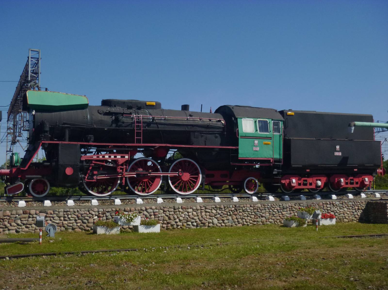
The trail starts and ends near the Korsze railway station. The settlement developed in the second half of 19th century, thanks to the decision to locate a large railway junction here. It was here where the long-distance railway lines between Königsberg - Odessa and Berlin - Vilnius intersected. The town was taken over by railwaymen, and life revolved for years around the railway station. The most important monuments in Korsze are railway water towers. The tower with a ball-shaped tank is especially valuable. This is one of the three towers with such design preserved in Poland. An old locomotive, located at the railway station, also reminds visitors of the railway nature of the city. The first interesting village on the route is Glitajny, where a farm complex and a park have survived. Further down on the trail the village of Parys is located, where you can see a big, Gothic church. Another village called Pomnik boasts an old water-mill and archaeological monuments.
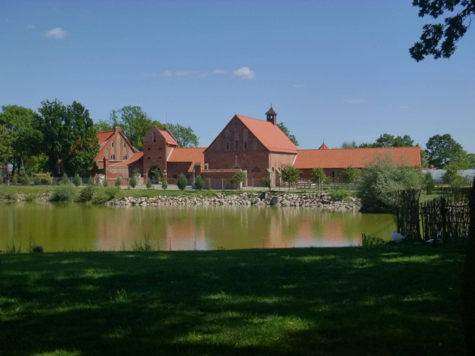
The route on the edge of the village of Drogosze turns south, but it is worth going further to see the Baroque palace of the Prussian von Dönhoff family, which is one kilometre away. This is the largest palace and park complex in the Masurian Lake District and one of the largest palaces of the former East Prussia. After returning to the trail, the cyclist goes through the valley of the Guber River, which flows to the Łyna river into the locality of Słonoczno. In the village of Warnikajmy attention is drawn by a huge, brick complex of farm buildings. It has a very unusual architecture, because its shape was modelled after the castle complex in the city of Malbork. This structure was created about 100 years ago, in the 1920s and has survived to date in quite good condition. There is a small exhibition of agricultural machinery nearby. The trail turns westwards from here and runs back to the Korsze station. On the way, it runs through the villages of Blogoszewo and Olszynka, where some remains of manor house estates and former parks have been preserved.
Points of interest along the trail:
- Korsze - railway station complex
- Glitajny - a farm complex, a former manor house park
- Parys - a Gothic church
- Pomnik - an old water-mill
- Drogosze (slightly off the trail) - the largest palace complex in the Warmia and Mazury Region
- Równina Dolna – remains of the fortified settlement
- Warnikajmy - a red brick grange, imitating the castle in Malbork
- Błogoszewo - remains of the manor house, former manor house park
- Olszynka – a manor house dating back to 19th century
The entire trail is suitable for bicycles with panniers/bike trailers. The trail uses solely roads with no motor vehicle traffic allowed, or local roads with a low and very low vehicle traffic; no dangerous intersections. A recreational trail. A trail with special cultural heritage value.
Starting point:
Korsze, intersection of Wolności and Kościuszki streets with the national road DK590
Finishing point:
Korsze, intersection of Wolności and Kościuszki streets with the national road DK590