
 Highest point
 Lowest point
 Sum of driveways
 Sum of downhill
 Slope
Slope Marking
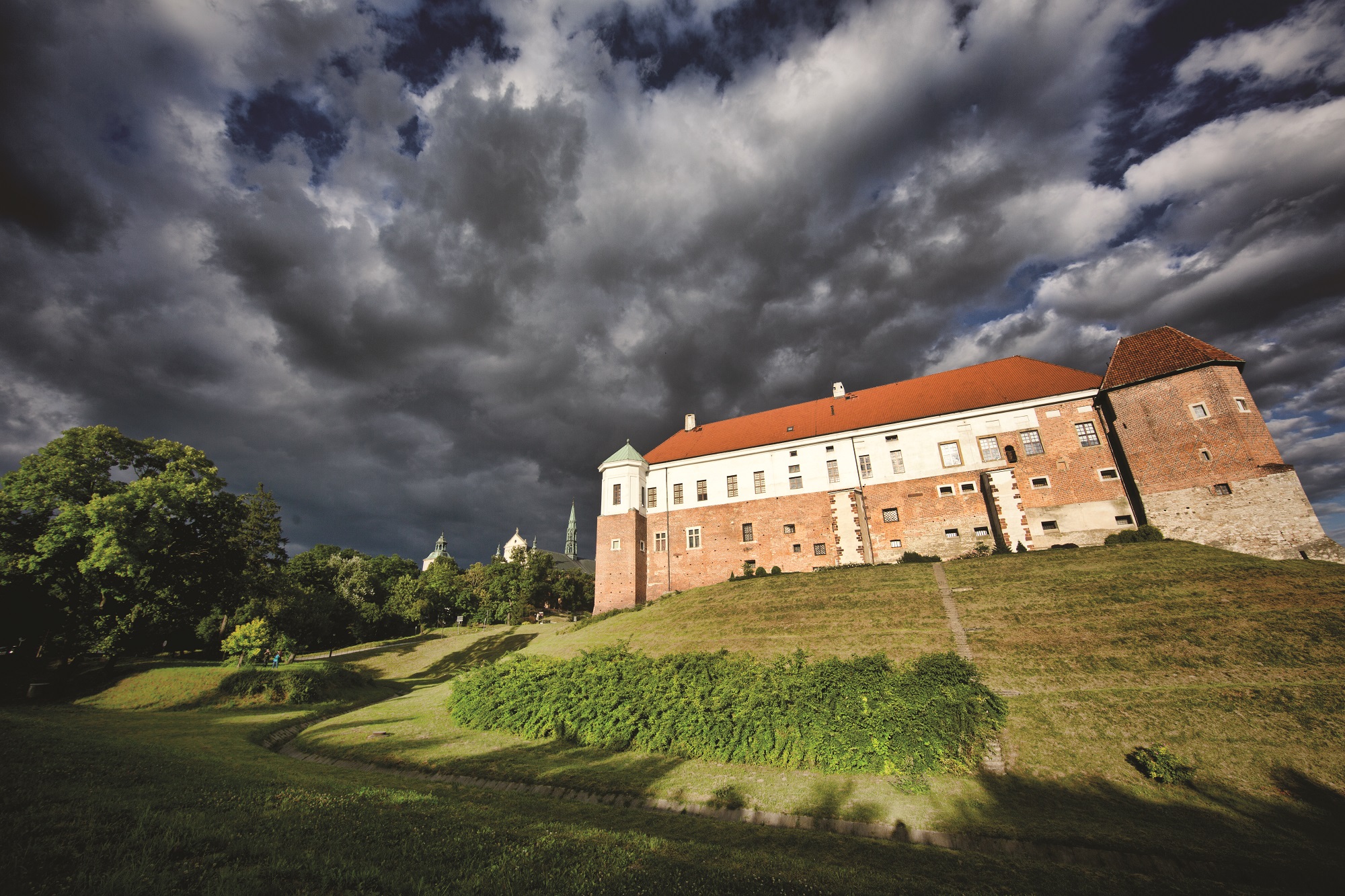
The black bike trail around the city of Sandomierz called "The Sandomierz Landscape" is 21.7 kilometres long and has the shape of a loop that surrounds the royal city from the north, south and west. It is one of the bike trails marked out by the Sandomierz branch of the Polish Tourism and Sightseeing Society (PTTK). The trail runs along hilly terrain, alternately rising and falling, running through picturesque apple and plum tree orchards that surround the city. It runs mainly on asphalt roads, with a low volume of road traffic, whereas the ascents and descents on the route are not too difficult. The route is therefore suitable for a trip of a recreational nature, it has great scenic and natural value. You will take 3 hours to cover the route and to see the nearby sights.
The general course of the trail is as follows: Sandomierz, ul. Żeromskiego, in the seminary area, starting point (0.0 km) - Chwałki (2.8 km) - Wysiadłów (6.8 km) - Sandomierz, national road no. 77 (12.0 km) - Andruszkowice (16.4 km) - Koćmierzów (18.2 km) - Sandomierz, vicinity of the Shell filling station, national road no. 79 (20.3 km) - Sandomierz, ul. Staromiejska, end of the trail (21.6 km).
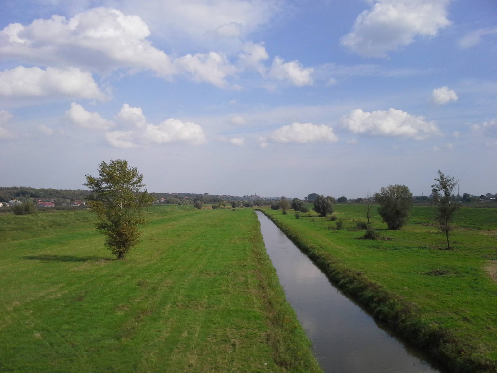
Sandomierz was founded on a site which had been important for centuries, at the mouth of the San River flowing into the Vistula River. It has a Medieval urban layout and about 120 architectural monuments dating back to various eras. Located among fruit orchards, the city, along with the surrounding area, is one of the most charming corners of Poland. The picturesque landscape of the area is distinguished by the picturesque ravine of the Vistula River flowing through the Pieprzowe Mountains Reserve, situated on the edge of the river valley, protecting the ancient Cambrian rocks cut by deep ravines and the loess ravine of St. Hedwig.
The trail starts near the historic city centre, at the Higher Theological Seminary and the Baroque St. Michael church and the former Benedictine nunnery. The trail runs along Żeromskiego street towards the north, passing a complex of military buildings that are the barracks of the radio engineering battalion.
Then it runs to the edge of the Opatówka river valley. Nearby, on a high hill, stands the so-called Chocimska Lighthouse. It is a lighthouse dating back to the second half of the 17th century, according to legend, funded by the knights who returned from the battle of Chocim. In the village of Wysiadłów, the route crosses the national road and turns south towards the city of Sandomierz, climbing the slopes of the hill on which Sandomierz is located.
Having reached the suburbs of Sandomierz, the route does not return to the city, but goes further south towards the Vistula River. In the surroundings of the village of Andruszkowice, the route descents with a rather sharp descent to the valley level, so that after crossing the Koprzywianka river, you will encounter the Green Velo trail in Koćmierzów.
Then both trails run along a local road along the Vistula River towards the city of Sandomierz. On national road no. 79, the Green Velo trail runs at the foot of the hill towards the Vistula River harbour and the Royal Castle, and the black trail climbs the hill running to the city centre. Near the place where the trail ends, there are Sandomierz ravines - the Queen Hedwig Ravine and the Piszczele Ravine, which are worth seeing during the bike trip.
Points of interest along the trail:
- Sandomierz - the historic city centre, numerous museums, churches, city fortifications, the Royal Castle
- Sandomierz – St. Hedwig and Piszczele ravines
- Ocinek - City Lighthouse
- Landscape of the Sandomierz area - fruit orchards, the city panorama and the Vistula River valley
The entire trail is suitable for bicycles with panniers/bike trailers. The trail runs separated from the traffic, only safe cycling through public roads, separate bike trails and roads without road traffic, dirt roads, forest roads and other roads. Trail with an outstanding natural beauty. A trail with special qualities of cultural heritage. Trail offering outstanding vistas.
Starting point:
Sandomierz, Żeromskiego street (the environs of the seminary)
Finishing point:
Sandomierz, Koseły street