
 Highest point
 Lowest point
 Sum of driveways
 Sum of downhill
 Slope
Slope Marking
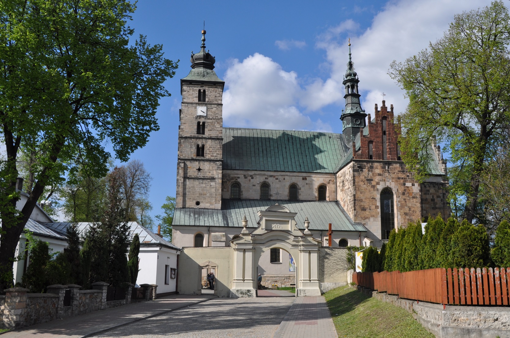
The green trail around Opatów is one of the bike trails marked out near this historic city. It has the shape of a loop and runs through the hilly areas of the Sandomierska Upland. The attraction of the route are the ruins of two castles, in Międzygórze and Tudorów. After rain, some sections of the route are difficult to pass because of the loamy loess roads, which cover a small part of trail. The remaining route covers asphalt roads, and the lack of steep ascents and the short length of the route make it suitable for a leisure trip also for less experienced cyclists.
The general route of the trail is as follows: Opatów, ul. Stefania Sempolowska, PKS bus terminal (0.0 km) - Nikisiałówka Duża (6.0 km) - Nikisiałówka Mała (8.0 km) - Malice Kościelne (10.7 km) - Słabuszewice (12.6 km) - Międzygórze (14.7 km) - Żurawniki (18.8 km) - Włostów (22.3 km) - Tudorów (24.6 km) - Opatów (29.1 km).
The route starts in Opatów, a city with many interesting sights. The history of the city is longer than 700 years, which is witnessed by the Romanesque collegiate St. Martin church, the Bernardine monastery and the famous Opatów dungeons. The city lies on the Opatówka river, where a part of the trail runs.
The trail starts in the north-eastern part of the city, by national road no. 74, leading to the city of Lublin, about 200 meters from the city centre. The trail runs on side country roads with surprisingly good asphalt pavement. Along the way, the cyclist passes numerous small villages and the landscape is hilly, typical of the Świętokrzyskie region. The area is not very densely populated, is picturesque and used for agricultural purposes. The further you go towards the city of Sandomierz, the more fruit orchards you can see along the way. Here and there the route crosses loess ravines specific to this area.
In Międzygórze, hidden among greenery, the impressive ruins of a Medieval stronghold have survived. The castle was built in the 14th century and expanded in the Renaissance style two centuries later. It was destroyed during the Swedish wars, but the fragments of the walls and walls of the building, surrounded by greenery, look impressive until today. It is also an attractive vantage point.
In the area of Międzygórze, archaeological sites were also discovered, burial mounds, indicating thousands of years of human settlement in this area. The nearby, closed quarry is an interesting geological site. The sedimentary rocks visible in quarry are very old, they date back to the early Palaeozoic era, a time when primordial life was just beginning to conquer the land. The quarry is approximately 1.5 kilometres from the village and the trail.
From the locality of Międzygórze the trail turns back to the west and climbs the ridge of the hill towards the village of Włostów. Next to it, in the village of Tudorów, on a hill surrounded on three sides by the meandering Opatówka river, there is a small remnant of another 14th century knight's castle, a four-sided tower. According to legend, the castle was built by Jan Tudor, whose descendants ruled on the English throne. The documents, however, attribute the building foundation to the knight Pełka. From Tudorów, the trail returns to Opatów, crossing the national road and then running through the hilly area to the centre of this historic city.
Points of interest along the trail:
- Opatów - Romanesque collegiate, monastery, dungeons
- Międzygórze - ruins of the castle, an old quarry
- Tudorów - castle ruins
- Landscapes of the Sandomierska Upland
The entire trail is suitable for bicycles with panniers/bike trailers. The trail runs only on roads without road traffic or on local roads with a low and very low volume of road traffic; no dangerous intersections. A recreational trail.
Starting point:
Opatów, Stefanii Sempołowskiej street
Finishing point:
Opatów, Partyzantów street, at the intersection with Armii Krajowej street