
 Highest point
 Lowest point
 Sum of driveways
 Sum of downhill
 High slope sections
 Slope
Slope Marking
The Bieliny Large Loop is a bike trail that is almost 40 kilometres long, marked out in the central part of the Świętokrzyskie Mountains. It starts and ends on Święty Krzyż, running on the roads and in off-road areas of the Bieliny Municipality. The trail is quite poorly signposted and sometimes very tough to ride, recommended only to cyclists on mountain bikes, well-trained in off-road cycling.
The general route of the trail is as follows: Święty Krzyż, parking area at the top (0.0 km) - Huta Szklana, Medieval settlement (2.1 km) - Kakonin (11.2 km) - Bieliny (17.4 km) - Makoszyn (23.2 km) - Lechów (27.3 km) - Bartoszowiny (32.6 km) - Huta Szklana, Medieval settlement (36.0 km) - Holy Cross, parking area at the top (38.1 km).
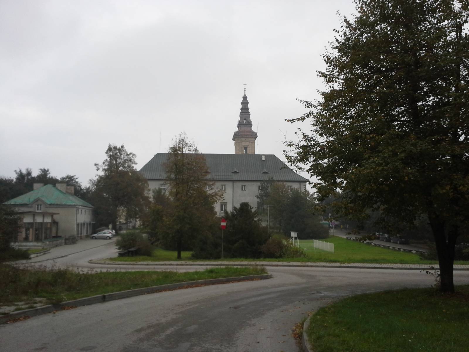
The route starts at the top of Mount Łysa Góra, which is 584 meters high and belongs to the Łysogóry range. Next to the highest Łysica peak, it is one of the two best-known peaks of the Świętokrzyskie Mountains. According to the legends, the witches held their Sabbaths on the top of Mount Łysa Góra in the Middle Ages, and in pre-Christian times it was a centre of religious worship. Stone circles have survived, where ancient rituals took place. Later, on the top of Mount Łysa Góra a monastery was built and the mountain was called Święty Krzyż (Holy Cross), and later the name was transferred to the whole mountain range. The monastery and the museum located indoors are worth visiting before the start of a cycling trip. Similarly, you must see boulder sites devoid of any trees, specific to the Świętokrzyskie Mountains. Święty Krzyż is a popular place for excursions, there are a lot of catering facilities here. On the top there is a huge telecommunications tower from which the route starts.
At first, it runs downhill to Huta Szklana, a settlement near the top, where another tourist complex is located. This is a Medieval settlement, a complex of facilities that create a replica of a Medieval village that makes a sort of a "live museum". Various kinds of shows, workshops and events take place here, where you can learn about life, faith and customs of the Medieval inhabitants of these areas. There is also a playground, tavern and tourist information desk.
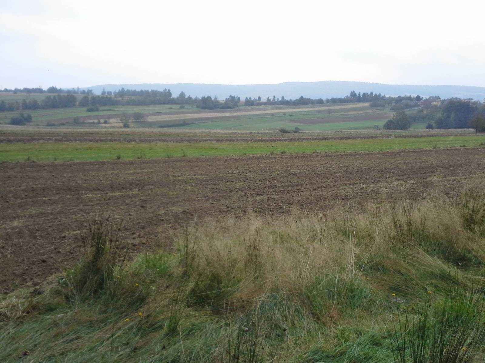
From the locality of Huta Szklana, the route runs to the west, through the forests located on the foothills of the Łysogóry Range, the villages of Podłysica and Kakonin, and then returns through the fields to the municipal village of Bieliny. You can see here a Baroque church, and the town is a local administrative and economic centre. From Bieliny the route continues further south, to the village of Makoszyn, in which there is also a historic church, actually a chapel dating back to the 19th century. Here the trail reaches the next range of the Świętokrzyskie Mountains, the Cisowsko-Orłowiński Range, and crosses the national road, turns north and heads through the villages of Lechów and Bartoszowiny, returning to Huta Szklana. From here, the cyclist still has an ascent over 100 meters long to the locality of Święty Krzyż.
The route is quite picturesque, but a few kilometres of the trail are marked out virtually through wilderness. For this reason, it is only suitable for mountain bikes. However, you can slightly modify the route, bypassing off-road sections on roads, making it much easier. You can also avoid the heavy ascent up Mount Łysa Góra, by starting and ending the trip in Huta Szklana.
Points of interest along the trail:
- Święty Krzyż - a monastery, museum, vantage point, boulder sites, the Świętokrzyski National Park
- Huta Szklana - Medieval settlement
- Views of the Świętokrzyskie Mountain ranges
Not all fragments of the trail are suitable for bicycles with panniers/bike trailers. The trail runs only on roads without road traffic or on local roads with a low and very low volume of road traffic; no dangerous intersections. A trail for lovers of mountain biking and off-road cycling.
Starting point:
Holy Cross, parking area at summit
Finishing point:
Holy Cross, parking area at summit