
 Highest point
 Lowest point
 Sum of driveways
 Sum of downhill
 Connected with GreenVelo
 Slope
Slope Marking
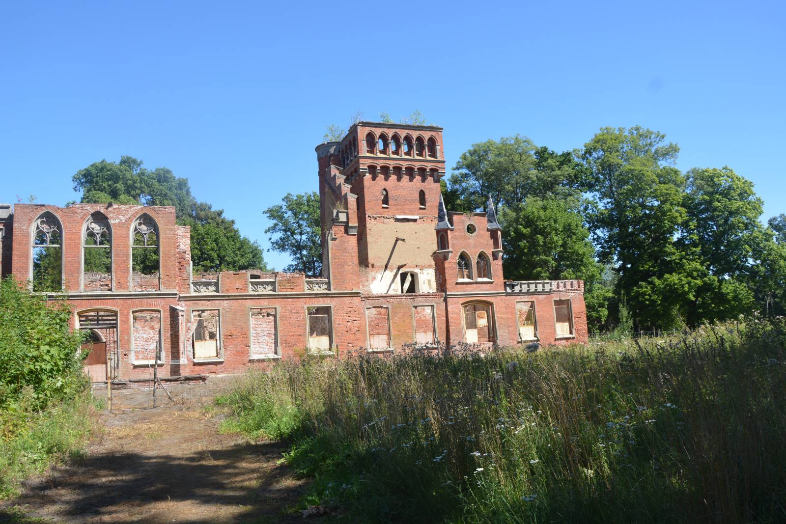
The green trail in the Korsze municipality is the longest and the most interesting of the four bike trails marked out near this town. It runs through rather flat terrain, asphalt roads and dirt roads to many interesting destinations, north of the railway junction and the city of Korsze. On the trail, there are old churches and manor house ruins, post-German farms and archaeological sites. The route has a recreational nature and is just over 30 kilometres long.
The general course of the trail is as follows: Korsze, station (0.0 km) - Głowbity, grange (3.3 km) - Prosna, ruins of the palace (13.1 km) - Sątoczno (14.8 km) - Stawnica (15,8 km) - Parys (27.0 km) - Glitajny (28.8 km) - Korsze (31.2 km).
The trail starts and ends near Korsze railway station. The settlement developed in the second half of 19th century, thanks to the decision to locate a large railway junction here. It was here where the long-distance railway lines between Königsberg - Odessa and Berlin - Vilnius intersected. The town was taken over by railwaymen, and life revolved around the railway station for years. The most important monuments in the city of Korsze are railway water towers. The tower with a ball-shaped tank is especially valuable. This is one of the three towers with such design preserved in Poland. A historic locomotive, located at the railway station, also reminds visitors about the railway nature of the city.
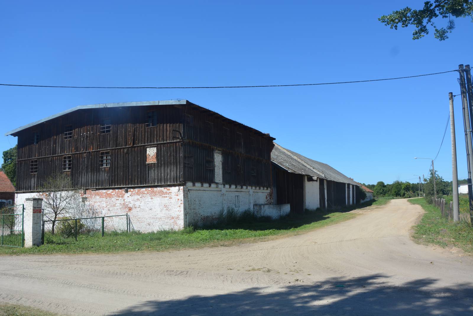
From the vicinity of the station, the trail runs westwards, to the village of Głowbity. You can see a complex of old farm buildings and a park there. Then the trail turns slightly northwards and runs next to the Studzieniec railway station towards the locality of Sątoczna, to the Guber river valley. There it runs to the village of Prosna, to the picturesque ruins of the palace, located in a beautiful park in the past. Then, along with the Green Velo route, the trail runs to the centre of Sątoczna. It is an old village, founded by the Teutonic Knights, whose most interesting monument is a large, brick Gothic church.
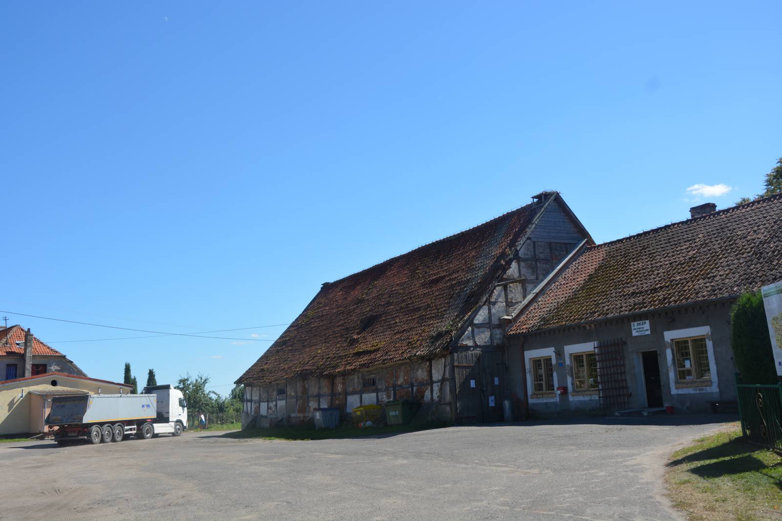
From the village of Sątoczna, the route runs eastwards, next to the village of Stawnica, where there are archaeological sites. Then, through forests and fields, mainly through dirt roads, the trail runs to the village of Parys, again encountering the signposting of the Green Velo route. From here, both routes run back to the Korsze railway station. On the way, it is worthwhile seeing another Gothic church in the village of Parys and manor house buildings in the locality of Glitajny.
Points of interest along the trail:
- Korsze – a railway station complex
- Glitajny - a park, a farm complex
- Paris - a Gothic church
- Sątoczno - a Gothic church
- Prosna - ruins of the palace, park
- Głowbity - a farm complex
- Stawnica – an archaeological site
The entire trail is suitable for bicycles with panniers/bike trailers. The trail uses solely roads with no motor vehicle traffic allowed, or local roads with a low and very low vehicle traffic; no dangerous intersections. A recreational trail.
Starting point:
Korsze, the building of the Townhall and Municipality Office
Finishing point:
Korsze, the building of the Townhall and Municipality Office