
 Highest point
 Lowest point
 Sum of driveways
 Sum of downhill
 Connected with GreenVelo
 Slope
Slope Marking
The Borderland Bike Trail is signposted in red, and is approximately 35 kilometres long. It runs in the form of a loop through the city of Sępopol and locality of Liski to the villages of Szczurkowo and Ostre Bardo located near the border with the Russian Federation. This small world forgotten by the rest of the world is one of the most peripheral parts of Poland. The trail runs almost entirely on asphalt roads with fragments of paved and slab sections. It is quite poorly signposted, devoid of recreational infrastructure. It runs mainly through open areas, which makes it highly exposed to the wind.
The general course of the trail is as follows: Sępopol (0.0 km) - Liski (6.3 km) – branching off with the Green Velo trail (9.8 km) - Judyty (13.6 km) - Szczurkowo, state border (17.8 km) - Ostre Bardo (23.9 km) – Stopki (28.2) - Sępopol (33.7 km).
Due to the proximity of the border, you must bring your identity card and expect a meeting with the border guards. At some places characteristic clumps of large "cauliflowers" of Sosnowsky’s hogweed grow on the trail – with this toxic (even at a distance) plant you should exercise particular caution.
In villages along the trail, numerous old red brick houses have survived. They are covered with ceramic tiles and have decorative cornices and friezes. Such design was characteristic for the whole area of East Prussia in the 19th and early 20th centuries. The buildings preserved to this day create a characteristic cultural landscape of the Warmia village. Despite the destruction caused by the Red Army during the 1945 offensive of and the subsequent long-term devastation of abandoned estates, the beauty of the old architecture has been rediscovered in recent years.
The trip begins and ends in Sępopol - a small town located in the Łyna bend, at the mouth of Guber river. In the 19th century, a requirement to build several bridges led the decision to build the main railway junction of East Prussia in the locality of Korsze, 12 km away. In 1945, the city of 80% of Sępopol was destroyed. One of the major monuments, the Gothic church of Saint Michael the Archangel dating back to 14th century, features a tower standing watch over the city, where a panorama deck was made at the height of approximately 60 m. Inside the temple you can see the Baroque main altar and the pulpit from the first half of the 17th century and the burial chapel of the Kunheim family, the owners of the palace in nearby Judyty. Next to the bridge over the Łyna river, a fragment of the defensive walls with the city's coat of arms has survived. An interesting structure is also the Art Nouveau water tower, built in 1912, which is still in use. The tower of the local church, dating back to the 14th century, has a panorama deck and a museum exhibition about the history of the city and the region. Leaving from Sępopol, it is worthwhile to pay attention to the preserved piece of the defensive walls with the coat of arms of the city placed on them.
The first section of the route runs together with the Green Velo route to the village of Liski. There is a stud farm of Trakehner (Prussian breed) horses here. Around the spacious courtyard there are farm buildings and the manor house of the farm administrator. The history of the stud farm dates back to 1740. After the war, the tradition of horse breeding was continued in the village of Liski, and for many years it was the largest stud farm in Poland. It is worthwhile to note the residential buildings and the former school next to the stud farm.
Then the route departs from the Green Velo route and runs north, towards the border between Poland and Russia, through Skitno to Judyty. In the village there is a neo-classical palace and park complex, dating back to 1863. The property is now privately owned. In 1928 Eberhard von Kuenheim was born in the palace, from the 1970s to the 1990s the director of the BMW Group.
From the village of Judyty, the trail continues to the locality of Szczurkowo near the borderline. In 1945, the village was divided by the border between Poland and the USSR. On the Russian side, the church and the palace remained – not a single trace of them has survived to date. On the outskirts of the village stands a milestone - a sign informing visitors of the distance to Königsberg, placed there in the first half of the 19th century. The area is also one of the largest concentrations of stork nests in the Warmia region.
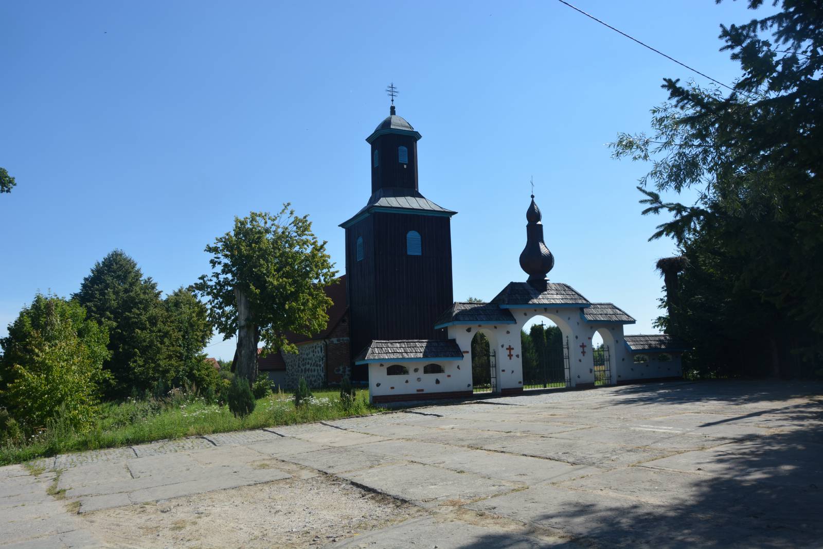
Further, along the fences and pillars of the border strip, the trail runs to Ostre Bardo. This village, also located on the Polish-Russian border, is largely inhabited by the Ukrainian population, resettled here from the Bieszczady Mountains during the "Vistula Operation" in 1947. In the city of Ostróda, there is a late-Gothic church from the 16th century, now a Greek Catholic church.
In the village of Stopki, located on the Łyna river, you can relax by the river, which creates a wide pool here. This is a result of the backwater caused by the dam of the hydroelectric power plant in the locality of Frydland (today's Prawdinsk), built in the 1920s. This largest hydroelectric power plant on the Łyna river is located on the Russian side. Eight smaller power plants are operated on the river on the Polish side. From Stopki, the trail runs through Długa back to the city of Sępopol.
Points of interest along the trail:
- Sępopol - monuments of the city, urban layout
- Liski - stud farm of the Trakehner horses
- Judyty - a palace complex dating back to the 19th century
- Szczurkowo - the border in the middle of the village, numerous stork nests
- Ostre Bardo – a Greek Catholic church
- "Borderland" atmosphere
The entire trail is suitable for bicycles with panniers/bike trailers. The trail runs on routes without road traffic, offering only safe cycling through public roads, separate bike trails and roads without road traffic, dirt roads, forest roads and others. A recreational trail.
Starting point:
Sępopol, next to the cemetery
Finishing point:
Sępopol, next to the cemetery